1958 Pacific typhoon season
| 1958 Pacific typhoon season |

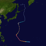
Season summary map
|
| Seasonal boundaries |
| First system formed |
January 6, 1958 |
| Last system dissipated |
December 8, 1958 |
| Strongest storm |
|
| Name |
Ida |
| • Maximum winds |
325 km/h (200 mph) |
| • Lowest pressure |
877 hPa (mbar) |
| Seasonal statistics |
| Total depressions |
24 |
| Total storms |
23 |
| Typhoons |
21 |
| Super typhoons |
9 |
| Total fatalities |
Unknown |
| Total damage |
Unknown |
| Related articles |
|
|
Pacific typhoon seasons
1956, 1957, 1958, 1959, 1960
|
| Category 5 super typhoon (SSHWS) |
|
|
| Duration |
January 6 – January 17 |
| Peak intensity |
260 km/h (160 mph) (1-min) 940 hPa (mbar) |
| Tropical Storm (SSHWS) |
|
|
| Duration |
April 29 – April 30 |
| Peak intensity |
95 km/h (60 mph) (1-min) 995 hPa (mbar) |
| Category 5 super typhoon (SSHWS) |
|
|
| Duration |
May 23 – June 2 |
| Peak intensity |
295 km/h (185 mph) (1-min) 940 hPa (mbar) |
| Tropical Storm (SSHWS) |
|
|
| Duration |
May 26 – June 6 |
| Peak intensity |
90 km/h (55 mph) (1-min) 990 hPa (mbar) |
| Category 1 typhoon (SSHWS) |
|
|
| Duration |
June 7 – June 13 |
| Peak intensity |
140 km/h (85 mph) (1-min) 985 hPa (mbar) |
| Tropical Storm (SSHWS) |
|
|
| Duration |
June 8 – June 13 |
| Peak intensity |
70 km/h (45 mph) (1-min) 998 hPa (mbar) |
| Category 3 typhoon (SSHWS) |
|
|
| Duration |
June 13 – June 17 |
| Peak intensity |
185 km/h (115 mph) (1-min) 985 hPa (mbar) |
| Category 1 typhoon (SSHWS) |
|
|
| Duration |
June 28 – July 6 |
| Peak intensity |
140 km/h (85 mph) (1-min) 1000 hPa (mbar) |
| Category 3 typhoon (SSHWS) |
|
|
| Duration |
July 8 – July 14 |
| Peak intensity |
185 km/h (115 mph) (1-min) 965 hPa (mbar) |
The scope of this article is limited to the Pacific Ocean, north of the equator and west of the international date line. Storms that form east of the date line and north of the equator are called hurricanes; see 1958 Pacific hurricane season. Tropical Storms formed in the entire west pacific basin were assigned a name by the Fleet Weather Center on Guam.
At noon on December 31, a vortex was noted along the Intertropical Convergence Zone about 1,300 miles (2,100 km) south of Hawaii. On January 7, the relatively small tropical storm struck Jaluit Atoll within the southern Marshall Islands, killing 14 people. It rapidly intensified, and reached winds of 140 miles per hour (230 km/h) the next day. Conditions became unfavorable, and steadily weakened to 105 miles per hour (169 km/h) winds. Ponape was struck on January 10, where Ophelia tore off the roof of the United States Weather Bureau office. On January 11, Truk was struck. The Weather Bureau's inflation shelter was destroyed, with other buildings on site severely damaged. On the 12th, favorable conditions allowed Ophelia to reintensify, reaching a peak of 160 miles per hour (260 km/h) on the 13th. Ophelia severely impacted Yap on January 13, removing the Weather Bureau office's sheet metal roof and damaging the inflation building, theodolite, and radio antenna. After maintaining that intensity for 18 hours, it quickly weakened as it drifted northward, and dissipated on the 17th. Typhoon Ophelia caused widespread on several islands of the Western Pacific. Ophelia also killed nine people when a USAF WB-50 crashed during a recon flight into the storm on January 15.
Tropical Storm 02 developed on April 29. It struck Philippines before dissipating on the following day.
On May 29, Super Typhoon Phyllis attained a peak of 185 miles per hour (298 km/h), the strongest typhoon ever in the month of May. Phyllis remained over open waters, and dissipated on the 2nd to the southeast of Japan. Phyllis's record was surpassed by Typhoon Damrey in 2000, and later Typhoon Noul in 2015.
...
Wikipedia


