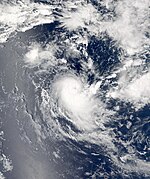
2012–13 South-West Indian Ocean cyclone season
| 2012–13 South-West Indian Ocean cyclone season |

Season summary map
|
| Seasonal boundaries |
| First system formed |
October 12, 2012 |
| Last system dissipated |
May 11, 2013 |
| Strongest storm |
|
| Name |
Anais |
| • Maximum winds |
185 km/h (115 mph)
(10-minute sustained) |
| • Lowest pressure |
945 hPa (mbar) |
| Seasonal statistics |
| Total disturbances |
11 |
| Total depressions |
10 |
| Total storms |
10 |
| Tropical cyclones |
7 |
| Intense tropical cyclones |
3 |
| Total fatalities |
35 total (16 missing) |
| Total damage |
~ $46 million (2013 USD) |
| Related articles |
|
|
South-West Indian Ocean tropical cyclone seasons
2010–11, 2011–12, 2012–13, 2013–14, 2014–15
|
| Intense tropical cyclone (MFR) |
| Category 4 tropical cyclone (SSHWS) |
|
|
| Duration |
October 12 – October 19 |
| Peak intensity |
185 km/h (115 mph) (10-min) 945 hPa (mbar) |
| Tropical disturbance (MFR) |
|
|
| Duration |
November 15 – November 16 |
| Peak intensity |
45 km/h (30 mph) (10-min) 1004 hPa (mbar) |
| Severe tropical storm (MFR) |
| Tropical storm (SSHWS) |
|
|
| Duration |
November 23 – November 26 |
| Peak intensity |
100 km/h (65 mph) (10-min) 987 hPa (mbar) |
| Intense tropical cyclone (MFR) |
| Category 4 tropical cyclone (SSHWS) |
|
|
| Duration |
December 6 – December 13 |
| Peak intensity |
165 km/h (105 mph) (10-min) 950 hPa (mbar) |
| Tropical cyclone (MFR) |
| Category 1 tropical cyclone (SSHWS) |
|
|
| Duration |
December 29 – January 5 |
| Peak intensity |
130 km/h (80 mph) (10-min) 968 hPa (mbar) |
| Moderate tropical storm (MFR) |
| Tropical storm (SSHWS) |
|
|
| Duration |
January 12 – January 17 |
| Peak intensity |
65 km/h (40 mph) (10-min) 996 hPa (mbar) |
| Intense tropical cyclone (MFR) |
| Category 4 tropical cyclone (SSHWS) |
|
|
| Duration |
January 26 – February 3 |
| Peak intensity |
165 km/h (105 mph) (10-min) 950 hPa (mbar) |
| Tropical cyclone (MFR) |
| Category 2 tropical cyclone (SSHWS) |
|
|
| Duration |
February 11 – February 15 |
| Peak intensity |
140 km/h (85 mph) (10-min) 960 hPa (mbar) |
| Tropical cyclone (MFR) |
| Category 3 tropical cyclone (SSHWS) |
|
|
| Duration |
February 18 – February 24 |
| Peak intensity |
150 km/h (90 mph) (10-min) 965 hPa (mbar) |
The 2012–13 South-West Indian Ocean cyclone season was an annual event in the cycle of tropical cyclone formation in the Southern hemisphere tropical cyclone year starting on July 1, 2012, and ending on June 30, 2013. Within this basin, tropical and subtropical disturbances are officially monitored by the Regional Specialised Meteorological Centre on Réunion island, while the Mauritius and Madagascar weather services assign names to significant tropical and subtropical disturbances. The first tropical disturbance of the season developed on October 12 and rapidly developed into the earliest known intense tropical cyclone on record during October 14.
The first tropical disturbance of the season developed on October 12 and gradually intensified to become the earliest known intense tropical cyclone on record on October 14.
On October 12, 2012, the JTWC issued a Tropical Cyclone Formation Alert (TCFA) on a system near the Chagos Islands. Soon afterwards, RSMC La Réunion designated the system as a tropical disturbance while located roughly 70 nautical miles (130 km) to the west of Diego Garcia. That afternoon, the JTWC upgraded the system into a tropical depression, giving it the designation 01S. The next day, RSMC La Réunion reported that the system had intensified into a moderate tropical storm and named it Anais. As the day progressed, Anais began a period of quick intensification—being upgraded into a tropical cyclone by RSMC La Réunion and a category one tropical cyclone by the JTWC.Anais continued to gradually intensify and was upgraded into an intense tropical cyclone by RSMC La Réunion early on October 14, while it was upgraded to a category 3 cyclone by the JTWC, as it started to form a well defined eye. Late on October 15, as it started to weaken, the system's eye started to collapse, but deep convection remained over the low level circulation center, and it was downgraded to a category 1 cyclone by October 16. On October 17, the system weakened into a tropical storm, and the low-level circulation center became totally exposed, with convection being displaced to the south due to moderate vertical wind shear from the north west. As the day progressed, Anais weakened into a tropical depression.On October 19, the remnants of Anais made landfall over Madagascar associated with a few burst of thunderstorms, before dissipating completely.
...
Wikipedia


