Adrian, Oregon
| Adrian, Oregon | |
|---|---|
| City | |

Event at school grounds in Adrian
|
|
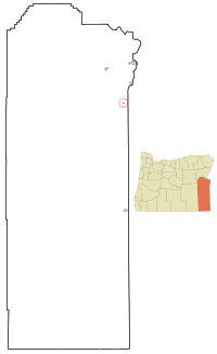
 Location in Oregon |
|
| Coordinates: 43°44′23″N 117°4′15″W / 43.73972°N 117.07083°WCoordinates: 43°44′23″N 117°4′15″W / 43.73972°N 117.07083°W | |
| Country | United States |
| State | Oregon |
| County | Malheur |
| Incorporated | 1972 |
| Government | |
| • Mayor | Vacant |
| Area | |
| • Total | 0.24 sq mi (0.62 km2) |
| • Land | 0.24 sq mi (0.62 km2) |
| • Water | 0 sq mi (0 km2) |
| Elevation | 2,225 ft (678 m) |
| Population (2010) | |
| • Total | 177 |
| • Estimate (2012) | 174 |
| • Density | 737.5/sq mi (284.8/km2) |
| Time zone | Mountain (UTC-7) |
| • Summer (DST) | Mountain (UTC-6) |
| ZIP code | 97901 |
| Area code(s) | 541 |
| FIPS code | 41-00500 |
| GNIS feature ID | 1135989 |
Adrian is a city in Malheur County, Oregon, United States, near the confluence of the Snake River and the Owyhee River. The population was 177 at the 2010 census. It is part of the Ontario, OR–ID Micropolitan Statistical Area.
In 1913, Oregon Short Line Railroad built a branch into this part of Malheur County. There was a post office called Riverview on the east side of the Snake River and because the railroad did not want a station of the same name on the west side, the name Adrian was suggested by Reuben McCreary, who platted the townsite. The name was chosen to honor his birthplace, Adrian, Illinois. Riverview post office was established in 1911, but moved across the river in 1915 and the name changed to Adrian in 1919. It was previously thought that the city was named for James Adrian, a sheep rancher, but he did not arrive in the area until 1916.
Adrian is located on the Southern Alternate route of the Oregon Trail, a longer route that eliminated the need to cross the Snake River.
According to the United States Census Bureau, the city has a total area of 0.24 square miles (0.62 km2), all of it land.
According to the Köppen Climate Classification system, Adrian has a semi-arid climate, abbreviated "BSk" on climate maps.
As of the census of 2010, there were 177 people, 70 households, and 45 families residing in the city. The population density was 737.5 inhabitants per square mile (284.8/km2). There were 78 housing units at an average density of 325.0 per square mile (125.5/km2). The racial makeup of the city was 89.8% White, 0.6% Native American, 1.1% Asian, 2.8% from other races, and 5.6% from two or more races. Hispanic or Latino of any race were 27.1% of the population.
...
Wikipedia
