Ahmadpur East Tehsil
|
تحصیل احمدپور شرقیہ Dera Nawab Sahib |
|
|---|---|
| Tehsil | |
| Ahmadpur Sharqia | |
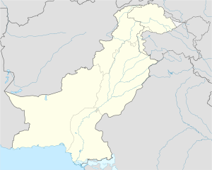
| Location in Pakistan | |
| Coordinates: 29°09′N 71°16′E / 29.150°N 71.267°E | |
| Country | Pakistan |
| Province | Punjab |
| District | Bahawalpur District |
| Population | |
| • Tehsil | 1,000,000 |
| • Urban | 200,000 |
| • Rural | 800,000 |
| Time zone | PST (UTC+5) |
| • Summer (DST) | +6 (UTC) |
| Area code(s) | 06222 |
Tehsil Ahmadpur East or Ahmadpur Sharqia (Punjabi, Saraiki, Urdu: تحصِيل احمدپُور شرقیہ) is one of the five tehsils, or administrative subdivisions, of Bahawalpur District in the Punjab province of Pakistan. Its capital is Ahmadpur East. With approximately 1 million inhabitants, it is the largest tehsil in terms of population in Pakistan. The main language spoken in the region is Saraiki. Urdu, Punjabi and Hindi are also spoken. Urdu and English are the official languages used in various educational and government institutions.
The city of Ahmadpur East was once the capital of the former Princely State of Bahawalpur. It takes its name from Ahmed Khan, the son of Ghappa Khan Parjani, who was the first cousin of Nawab Sadiq Muhammad Khan I. On the invitation of Nawab Mubarak Khan, the dwelling where Ahmed Khan along with his family, tribe and supporters made their permanent abode was designated Ahmed Pur and the modern name is derived from this. Numerous important buildings and places constructed by the former rulers of Bahawalpur State remain in the city, including Sadiq Garh Palace, Qadeem Mahal and Jamia Masjid Chowk Bazaar.
The city lies just south east of the Head Panjnad. It is situated 50 km from Bahawalpur, 470 km from Lahore, 15 km from Uch Shareef, 60 km from Yazman, 320 km from Faisalabad and about 750 km from the national capital, Islamabad. The west region of the city is called the Sindh. The chief crops are wheat, gram, cotton, sugarcane, and dates. Sheep and cattle are raised for export of wool and hides. It is chiefly desert irrigated by the Sutlej inundation canals and yields crops of wheat, cotton, and sugarcane. Farther south, the Cholistan, is a barren desert tract, bounded on the north and west by the Hakra depression with mound ruins of old settlements along its high banks; it is still inhabited by nomads. The climate is mainly hot and dry. In summer's the temperature reaches high forties degrees Celsius during the day and the nights slightly cooler. Since the city is located in a desert environment there is little rainfall. The weather conditions in reach extremes in both summer and winter. Average temperature in summer is 33c and 18c in winter. Rainfall is very scarce and scanty. The average rainfall is 20 to 25 cm annually
...
Wikipedia

