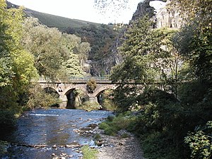
Ahr
| Ahr | |
| River | |
|
In the valley of the Ahr
|
|
| Name origin: Old High German aha ("water") | |
| Country | Germany |
|---|---|
| Source | |
| - location | Blankenheim, Northern Eifel, North Rhine-Westfalia, Germany |
| - elevation | 470 m (1,542 ft) |
| - coordinates | 50°26′17″N 7°16′37″E / 50.43806°N 7.27694°E |
| Mouth | Rhine |
| - location | Remagen, Rhineland-Palatinate, Germany |
| - elevation | 58 m (190 ft) |
| - coordinates | 50°33′34″N 7°16′37″E / 50.55944°N 7.27694°ECoordinates: 50°33′34″N 7°16′37″E / 50.55944°N 7.27694°E |
| Length | 89 km (55 mi) |
| Basin | 900 km2 (347 sq mi) |
| Discharge | |
| - average | 8.9 m3/s (314 cu ft/s) |
|
The Ahr River
|
|
Ahr is a river in Germany, a left tributary of the Rhine. Its source is at an elevation of approximately 470 metres (1,540 ft) above sea level in Blankenheim in the Eifel, in the cellar of a timber-frame house near the castle of Blankenheim. After 18 kilometres (11 mi) it crosses from North Rhine-Westphalia into Rhineland-Palatinate.
The Ahr flows through Ahr valley or Ahrtal, passing through the towns of Schuld, Altenahr and Bad Neuenahr-Ahrweiler. Between Remagen and Sinzig (south of Bonn), at about 50 metres (160 ft) above sea level, it flows into the Rhine. The length is roughly 89 kilometres (55 mi), of which 68 kilometres (42 mi) is within Rhineland-Palatinate. The Ahr has a gradient of 0.4 percent in its lower course, and 0.4 to 0.8 percent in its upper course.
The Ahr and its tributaries are a main drainage system of the eastern Eifel. The watershed is approximately 900 square kilometres (350 sq mi).
There were isolated settlements in the Ahr valley beginning at the latest in Roman times, evidenced by the Roman villa near Ahrweiler. Owing to their isolated location, the upper and middle parts of the course were sparsely populated.
That changed from the mid-19th century. The development of the settlements, the traffic routes and the agricultural areas in the Ahr valley led to the fact that the riverbed was fixed.
The Ahr rises in the middle of the village of Blankenheim, in the Eifel region of the German state of North Rhine-Westphalia, in the basement of a timber-framed house in an enclosed spring at a height of 474 m above sea level (NHN). It then flows through the Schwanenweiher pond below Blankenheim Castle.
...
Wikipedia


