Alleghany County, Virginia
| Alleghany County, Virginia | ||
|---|---|---|
| County | ||
| Alleghany County | ||

The Alleghany Courthouse in Covington.
|
||
|
||
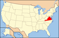
 Location in the U.S. state of Virginia |
||
 Virginia's location in the U.S. |
||
| Founded | 1822 | |
| Named for | Alleghany Mountains | |
| Seat | Covington | |
| Largest town | Clifton Forge | |
| Area | ||
| • Total | 449 sq mi (1,163 km2) | |
| • Land | 445 sq mi (1,153 km2) | |
| • Water | 3.3 sq mi (9 km2), 0.7% | |
| Population (est.) | ||
| • (2015) | 15,677 | |
| • Density | 35/sq mi (14/km²) | |
| Congressional district | 9th | |
| Time zone | Eastern: UTC-5/-4 | |
| Website | www |
|
Alleghany County is an American county located on the far western edge of Commonwealth of Virginia. It is bordered by the Allegheny Mountains, from which the county derives its name, and it is the northernmost part of the Roanoke Region of Virginia. The county seat is Covington.
The county was created in 1822 from parts of Botetourt County, Bath County, and Monroe County (now in West Virginia). At the time, the majority of the population lived around Covington, and the primary cash crop then was hemp, which was used for rope production.
As of the 2010 census, the population was 16,250, which is an increase of more than twenty-five percent from the 2000 census. The majority of that growth, however, can be attributed to the reincorporation of the formerly independent city of Clifton Forge back into Alleghany County in 2001.
Alleghany County was established on January 5, 1822 by an act of the Virginia General Assembly. The new county was formed from parts of Botetourt, Bath, and Monroe (now West Virginia) counties, with most of the population centered in the new county seat in Covington. Alleghany County was named for the Allegheny Mountains, which border the western edge of the County.
...
Wikipedia

