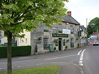
Aller, Somerset
| Aller | |
|---|---|
 The Old Pound Inn, Aller |
|
| Aller shown within Somerset | |
| Population | 410 (2011) |
| OS grid reference | ST4029 |
| Shire county | |
| Region | |
| Country | England |
| Sovereign state | United Kingdom |
| Post town | Langport |
| Postcode district | TA10 |
| Police | Avon and Somerset |
| Fire | Devon and Somerset |
| Ambulance | South Western |
| EU Parliament | South West England |
Aller is a village and parish in Somerset, England, situated 5 miles (8.0 km) west of Somerton on the A372 road towards Bridgwater in the South Somerset district. The village has a population of 410. The parish includes the hamlet of Beer (sometimes Bere) and the deserted medieval village of Oath on the opposite bank of the River Parrett.
Aller was listed in the Domesday Book of 1086 as Alre, meaning 'The alder tree' from the Old English alor.
The parish of Aller was part of the hundred of Somerton.
Most of the valuable meadows had been enclosed by 1577, but the surrounding fields were not enclosed until 1797. Between 1614 and 1616 there was a struggle between the lord, Sir John Davis, who had recently purchased the manor, and the tenants over the building of hedges and gates to increase the value of the remaining 47 acres (19 ha) of common ground. The meadows remained open and Davis sold the manor to John Stawell of Cothelstone in 1623.
Oath Lock marks the tidal limit of the River Parrett. It was added when it was realised that the locks at Stanmoor, Langport and Muchelney, with a half-lock at Thorney, would not provide the depth of water specified in the Act of Parliament of 4 July 1836 which authorised the building of the navigation.
...
Wikipedia

