Allons, Alpes-de-Haute-Provence
|
Allons Alonh |
||
|---|---|---|
| Commune | ||

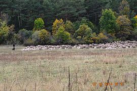
Herding sheep in Allons
|
||
|
||
| Coordinates: 43°58′42″N 6°35′45″E / 43.9783°N 6.5958°ECoordinates: 43°58′42″N 6°35′45″E / 43.9783°N 6.5958°E | ||
| Country | France | |
| Region | Provence-Alpes-Côte d'Azur | |
| Department | Alpes-de-Haute-Provence | |
| Arrondissement | Castellane | |
| Canton | Castellane | |
| Intercommunality | Moyen Verdon | |
| Government | ||
| • Mayor (2014-2020) | Christophe Iacobbi | |
| Area1 | 41.71 km2 (16.10 sq mi) | |
| Population (2014)2 | 149 | |
| • Density | 3.6/km2 (9.3/sq mi) | |
| Time zone | CET (UTC+1) | |
| • Summer (DST) | CEST (UTC+2) | |
| INSEE/Postal code | 04005 /04170 | |
| Elevation | 951–1,992 m (3,120–6,535 ft) (avg. 1,073 m or 3,520 ft) |
|
|
1 French Land Register data, which excludes lakes, ponds, glaciers > 1 km² (0.386 sq mi or 247 acres) and river estuaries. 2Population without double counting: residents of multiple communes (e.g., students and military personnel) only counted once. |
||
1 French Land Register data, which excludes lakes, ponds, glaciers > 1 km² (0.386 sq mi or 247 acres) and river estuaries.
Allons is a commune in the Alpes-de-Haute-Provence department in the Provence-Alpes-Côte d'Azur region of southeastern France.
The inhabitants of the commune are known as Allonsais or Allonsaises'
Allons occupies an area mainly located in the small valley of the Ivoire, a tributary of the Verdon, away from the main road of the valley of the Verdon some 60 km north-west of Nice and 40 km south-east of Digne. There are two natural closures of the site, one at Vauclause which corresponds to the edge of the commune at the valley of the Verdon, the other immediately at the exit of the village where the remains of a fortification can be seen.
The village is situated at 1073 m altitude.
The only access to the commune is via road D52 which runs south-east to the village from Road D955 some 6 km north-east of Saint-Andre-les-Alpes.
The commune is mountainous with high points including:
The commune is traversed by the Ivoire stream into which many streams flow from the mountains. The Ivoire flows into the Verdon which is a 165.9 km long river, a tributary of the Durance, which forms the north-western border of the commune.
The commune is a Drainage basin oriented east-west resulting in a large shady side and a large south-facing slope. On the shady side, there are Pine forests. There is a forest of beech trees growing near the village. A Riparian forest with abundant willow trees grows along the Ivoire stream.
There is a railway station at the intersection of the roads called Allons-Argens Halt which is an optional stop on the metre-gauge Nice to Digne line of the Chemins de Fer de Provence.
...
Wikipedia


