Alonei Abba
|
Alonei Abba אַלּוֹנֵי אַבָּא |
|
|---|---|
| Hebrew transcription(s) | |
| • official | Allone Abba |
 |
|
| Coordinates: 32°43′46.2″N 35°10′18.47″E / 32.729500°N 35.1717972°ECoordinates: 32°43′46.2″N 35°10′18.47″E / 32.729500°N 35.1717972°E | |
| Grid position | 166/237 PAL |
| District | Northern |
| Council | Jezreel Valley |
| Region | Lower Galilee |
| Affiliation | HaOved HaTzioni |
| Founded | 1948 |
| Founded by | Austrian and Romanian immigrants |
| Population (2015) | 1,000 |
| Website | aloneyaba.org.il |
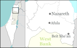
Alonei Abba (Hebrew: אַלּוֹנֵי אַבָּא, lit. Abba's Oaks) is a moshav shitufi, or semi-cooperative village, in northern Israel. It is located in the Lower Galilee near Bethlehem of Galilee and Alonim, in the hills east of Kiryat Tivon. Alonei Abba falls under the jurisdiction of the Jezreel Valley Regional Council. In 2015 it had a population of 1,000.
Archaeological investigations indicate that this was an industrial agricultural processing area in the Hellenistic and Roman periods. Among the remains found are Roman-period industrial oil press and a winepress, in addition to a paved path from the same era.
The village appeared as Umm el Amed (Arabic: ام العمد) on the map of Pierre Jacotin compiled in 1799.
In 1859, the British consul Rogers stated that the population of Umm al-Amed was 100 souls, and the tillage was ten feddans.
In 1875 Victor Guérin found Umm al-Amed situated on a small plateau, surrounded by gardens. In spite of its name Umm al-Amed, which meant "The place with the columns", Guérin could find no columns.
In 1881, the Palestine Exploration Fund's Survey of Western Palestine described it as standing in oak-woods on a hill-top. There was an ancient rock-cut sepulchre on the east side.
...
Wikipedia

