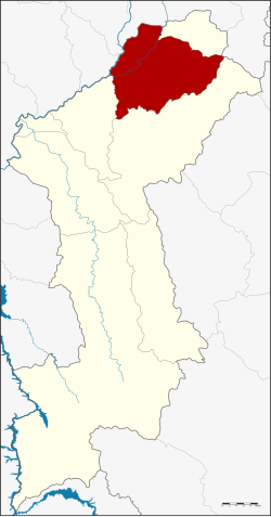
Amphoe Mueang Lamphun
|
Mueang Lamphun เมืองลำพูน |
|
|---|---|
| Amphoe | |
 Amphoe location in Lamphun Province |
|
| Coordinates: 18°34′41″N 99°1′4″E / 18.57806°N 99.01778°ECoordinates: 18°34′41″N 99°1′4″E / 18.57806°N 99.01778°E | |
| Country |
|
| Province | Lamphun |
| Area | |
| • Total | 479.8 km2 (185.3 sq mi) |
| Population (2005) | |
| • Total | 140,486 |
| • Density | 292.8/km2 (758/sq mi) |
| Time zone | THA (UTC+7) |
| Postal code | 51000 |
| Geocode | 5101 |
Mueang Lamphun (Thai: เมืองลำพูน; IPA: [mɯ̄aŋ lām.pʰūːn]) is the capital district (amphoe mueang) of Lamphun Province, northern Thailand.
Neighboring districts are (from the south clockwise) Mae Tha and Pa Sang of Lamphun Province, San Pa Tong, Hang Dong, Saraphi of Chiang Mai Province, Ban Thi of Lamphun and Mae On of Chiang Mai again.
The main river of the district is the Ping River.
The district is subdivided into 17 subdistricts (tambon), which are further subdivided into 158 villages (muban). The town (thesaban mueang) Lamphun covers the whole tambon Nai Mueang. There are three more subdistrict municipalities (thesaban tambon) - Umong and Rim Ping cover the complete same-named tambon, and Ban Paen parts of tambon Ban Paen and Nong Nam. There are further 12 Tambon administrative organizations (TAO).
...
Wikipedia
