Arden Hills, Minnesota
| Arden Hills, Minnesota | |
|---|---|
| City | |
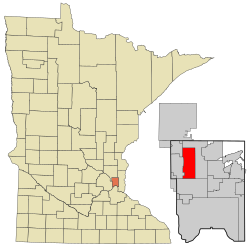
 Location of the city of Arden Hills within Ramsey County, Minnesota |
|
| Coordinates: 45°3′11″N 93°10′1″W / 45.05306°N 93.16694°WCoordinates: 45°3′11″N 93°10′1″W / 45.05306°N 93.16694°W | |
| Country | United States |
| State | Minnesota |
| County | Ramsey |
| Incorporated | 1951 |
| Area | |
| • Total | 9.65 sq mi (24.99 km2) |
| • Land | 8.59 sq mi (22.25 km2) |
| • Water | 1.06 sq mi (2.75 km2) |
| Elevation | 938 ft (286 m) |
| Population (2010) | |
| • Total | 9,552 |
| • Estimate (2012) | 9,750 |
| • Density | 1,112.0/sq mi (429.3/km2) |
| Time zone | Central (CST) (UTC-6) |
| • Summer (DST) | CDT (UTC-5) |
| ZIP code | 55112 |
| Area code(s) | 651 |
| FIPS code | 27-02026 |
| GNIS feature ID | 0639428 |
| Website | www.ci.arden-hills.mn.us |
Arden Hills is a city in Ramsey County, Minnesota, United States. The population was 9,552 at the 2010 census.Bethel University and Seminary is located in the city of Arden Hills. Also, the campus of University of Northwestern – St. Paul straddles the Arden Hills – Roseville border. The headquarters of Land O'Lakes and Catholic United Financial, a fraternal benefit society, are located there as well.
According to the United States Census Bureau, the city has a total area of 9.65 square miles (24.99 km2), of which 8.59 square miles (22.25 km2) is land and 1.06 square miles (2.75 km2) is water.
Interstate Highway 35W, Interstate Highway 694, U.S. Highway 10, Minnesota Highway 51/Snelling Avenue, and County Highway 96 are some of the main routes in the city.
As of the census of 2010, there were 9,552 people, 2,957 households, and 2,019 families residing in the city. The population density was 1,112.0 inhabitants per square mile (429.3/km2). There were 3,053 housing units at an average density of 355.4 per square mile (137.2/km2). The racial makeup of the city was 90.3% White, 1.7% African American, 0.2% Native American, 4.9% Asian, 1.0% from other races, and 1.9% from two or more races. Hispanic or Latino of any race were 2.8% of the population.
...
Wikipedia
