Arecibo Field
| Antonio (Nery) Juarbe Pol Airport | |||||||||||
|---|---|---|---|---|---|---|---|---|---|---|---|
| Summary | |||||||||||
| Airport type | Public | ||||||||||
| Owner | Puerto Rico Ports Authority | ||||||||||
| Serves | Arecibo, Puerto Rico | ||||||||||
| Elevation AMSL | 23 ft / 7 m | ||||||||||
| Coordinates | 18°27′04″N 066°40′32″W / 18.45111°N 66.67556°WCoordinates: 18°27′04″N 066°40′32″W / 18.45111°N 66.67556°W | ||||||||||
| Map | |||||||||||
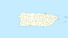
| Location of airport in Puerto Rico | |||||||||||
| Runways | |||||||||||
|
|||||||||||
| Statistics (1998) | |||||||||||
|
|||||||||||
|
Source: Federal Aviation Administration
|
|||||||||||
| Aircraft operations | 1,836 |
|---|
Antonio (Nery) Juarbe Pol Airport (IATA: ARE, ICAO: TJAB, FAA LID: ABO) is a public use airport located three nautical miles (6 km) of the central business district of Arecibo, Puerto Rico. It is owned by the Puerto Rico Ports Authority. This airport is included in the National Plan of Integrated Airport Systems for 2011–2015, which categorized it as a general aviation airport.
Although most U.S. airports use the same three-letter location identifier for the FAA and IATA, Antonio (Nery) Juarbe Pol Airport is assigned ABO by the FAA and ARE by the IATA (which assigned ABO to Aboisso Airport in Aboisso, Côte d'Ivoire). The airport's ICAO identifier is TJAB.
During World War II, the airport was used by the United States Army Air Forces Sixth Air Force conducting antisubmarine patrols. It was known as Arecibo Field. Flying units using the airfield were:
...
Wikipedia

