Arkoma, Oklahoma
| Arkoma, Oklahoma | |
|---|---|
| Town | |
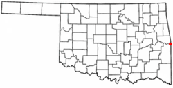
 Location of Arkoma, Oklahoma |
|
| Coordinates: 35°20′58″N 94°26′15″W / 35.34944°N 94.43750°WCoordinates: 35°20′58″N 94°26′15″W / 35.34944°N 94.43750°W | |
| Country | United States |
| State | Oklahoma |
| County | Le Flore |
| Area | |
| • Total | 3.6 sq mi (9.3 km2) |
| • Land | 3.5 sq mi (9.1 km2) |
| • Water | 0.1 sq mi (0.2 km2) |
| Elevation | 518 ft (158 m) |
| Population (2010) | |
| • Total | 1,989 |
| • Density | 550/sq mi (210/km2) |
| Time zone | Central (CST) (UTC-6) |
| • Summer (DST) | CDT (UTC-5) |
| ZIP code | 74901 |
| Area code(s) | 539/918 |
| FIPS code | 40-02650 |
| GNIS feature ID | 1089693 |
Arkoma is a town in Le Flore County, Oklahoma, United States. It is part of the Fort Smith, Arkansas-Oklahoma Metropolitan Statistical Area. The population was 1,989 at the 2010 census, a decline from 2,180 at the 2000 census. The name of the town is a portmanteau of Arkansas and Oklahoma. Throughout its history, Arkoma has served as a "bedroom community" because many residents commuted to work in Fort Smith.
The community of Arkoma was established about 1911 on land owned by Captain James Reynolds, a Civil War veteran who had married into the Choctaw Nation. He decided to develop his property as a suburb of Fort Smith, constructed houses to rent, and persuaded the Fort Smith Light and Traction Company to build tracks and run a regular electric trolley route to his new community. The streetcar line ceased operating in 1917.
Arkoma was incorporated as a town in 1946.
Arkoma is located at 35°20′58″N 94°26′15″W / 35.34944°N 94.43750°W (35.349516, -94.437558). It is just across the Arkansas River from Fort Smith, Arkansas.
According to the United States Census Bureau, the town has a total area of 3.6 square miles (9.3 km2), of which, 3.5 square miles (9.1 km2) of it is land and 0.1 square miles (0.26 km2) of it (2.23%) is water.
Arkoma enjoys a temperate climate with often mild winters and hot summers. Arkoma is near an area known as Tornado Alley.
...
Wikipedia
