Auray
|
Auray An Alre |
||
|---|---|---|

The harbour of St Goustin, the old part of Auray. The two are separated by the River Auray.
|
||
|
||
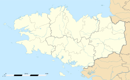
| Coordinates: 47°40′07″N 2°58′53″W / 47.6686°N 2.9814°WCoordinates: 47°40′07″N 2°58′53″W / 47.6686°N 2.9814°W | ||
| Country | France | |
| Region | Brittany | |
| Department | Morbihan | |
| Arrondissement | Lorient | |
| Canton | Auray | |
| Intercommunality | Pays d'Auray | |
| Government | ||
| • Mayor (2008–2014) | Michel Le Scouarnec | |
| Area1 | 6.91 km2 (2.67 sq mi) | |
| Population (2009)2 | 12,187 | |
| • Density | 1,800/km2 (4,600/sq mi) | |
| Time zone | CET (UTC+1) | |
| • Summer (DST) | CEST (UTC+2) | |
| INSEE/Postal code | 56007 / 56400 | |
| Elevation | 0–43 m (0–141 ft) (avg. 37 m or 121 ft) |
|
|
1 French Land Register data, which excludes lakes, ponds, glaciers > 1 km² (0.386 sq mi or 247 acres) and river estuaries. 2Population without double counting: residents of multiple communes (e.g., students and military personnel) only counted once. |
||
1 French Land Register data, which excludes lakes, ponds, glaciers > 1 km² (0.386 sq mi or 247 acres) and river estuaries.
Auray (Breton: An Alre) is a commune in the Morbihan department in Brittany in northwestern France.
Inhabitants of Auray are called Alréens.
The city is surrounded by the communes of Crac'h to the south and west, Brech to the north and Pluneret to the east. It is crossed by the Loch, a small coastal river which flows into the Gulf of Morbihan. The town is high on the west bank of the river Auray on the edge of the Armorican plateau which is cut deeply by the river. The port of Saint-Goustan is also in the valley, east of the River.
The port of Saint-Goustan is the site of the original town. It is located on the River Auray at the highest tidal reach of the river that ships can access. It was open to ships until the nineteenth century and was also a trading port which was particularly active in its routes with Spain and Britain. The decline of trade in the port began with the arrival of the railway in 1862 and today it is a marina and port of call on tours of the Gulf of Morbihan.
Saint-Goustan, located in the lower town, is the first point at which the river can be bridged on the coastal road between Vannes and Quimper. Downstream, the River Auray is wide and steep. Upstream, the marshes of the Loch valley makes passage difficult to Tréauray which is 4 km to the north. The Roman road from Lyon to Gésocribate (Le Conquet) via Nantes, passes the commune.
In the mid-19th century, the construction of a new road on an embankment on the marshes of Loch allowed direct access to the town from Vannes. In 1950, the Vannes-Lorient route nationale bypassed the centre of Auray to the north. In 1989, the four-carriageway Kerplouz viaduct was built on the RN165 over the Auray river downstream from St. Goustan. This rid the town of transit traffic, and created an industrial area south of the city centre.
...
Wikipedia


