Baignes-Sainte-Radegonde
| Baignes-Sainte-Radegonde | ||
|---|---|---|
| Commune | ||

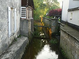
The Pharaon at Baignes-Sainte-Radegonde
|
||
|
||
| Coordinates: 45°23′05″N 0°14′06″W / 45.3847°N 0.235°WCoordinates: 45°23′05″N 0°14′06″W / 45.3847°N 0.235°W | ||
| Country | France | |
| Region | Nouvelle-Aquitaine | |
| Department | Charente | |
| Arrondissement | Cognac | |
| Canton | Charente-Sud | |
| Intercommunality | 3B - Sud-Charente | |
| Government | ||
| • Mayor (2014–2020) | Gérard Delétoile | |
| Area1 | 31.22 km2 (12.05 sq mi) | |
| Population (2010)2 | 1,326 | |
| • Density | 42/km2 (110/sq mi) | |
| Time zone | CET (UTC+1) | |
| • Summer (DST) | CEST (UTC+2) | |
| INSEE/Postal code | 16025 /16360 | |
| Elevation | 51–148 m (167–486 ft) (avg. 75 m or 246 ft) |
|
|
1 French Land Register data, which excludes lakes, ponds, glaciers > 1 km² (0.386 sq mi or 247 acres) and river estuaries. 2Population without double counting: residents of multiple communes (e.g., students and military personnel) only counted once. |
||
1 French Land Register data, which excludes lakes, ponds, glaciers > 1 km² (0.386 sq mi or 247 acres) and river estuaries.
Baignes-Sainte-Radegonde is a commune in the Charente department in the Nouvelle-Aquitaine region of south-western France.
The inhabitants of the commune are known as Baignois or Baignoises.
The commune has been awarded one flower by the National Council of Towns and Villages in Bloom in the Competition of cities and villages in Bloom.
Baignes-Sainte-Radegonde is the capital of its Canton and also of Petit Angoumois, a natural region of pine forests and lakes in the south-west of Charente. The commune is located some 15 km south-east of Jonzac and 18 km north of Montlieu-la-Garde. The northern, western, and southern borders of the commune are also the departmental border between Charente and Charente-Maritime. The town is located on the eastern border of the commune and is accessed by the D2 from Brossac in the south-east which passes through the town then continues west, changing to the D152 in Charente-Maritime, then continuing south-west to Montendre. The D14 comes from Le Tâtre in the north-east passing through the town and continuing south-east, changing to the D155 in Charente-Maritime, to Bran. The D100 goes north-west from the town, changing to the D152E1 in Charente-Maritime, to Saint-Maigrin. The D38 goes north from the town to Lamérac. The D132 branches from the D38 south of the town and goes south-east to Bors and also branches off the D2 in the west and goes north-west, changing to the D142E2 in Charente-Maritime, to Mortiers. The D446 branches from the D2 in the west of the commune and goes south-east, changing to the D255 in Charente-Maritime, to Vanzac. Route nationale N10 (E606) forms the south-eastern border of the commune.
...
Wikipedia


