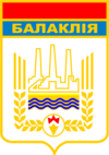
Balakliia
|
Balakliia Балаклія |
||
|---|---|---|

Main Street of Balakliia
|
||
|
||
 Map of Ukraine with Balakliia highlighted |
||
| Location of Balakliia | ||
| Coordinates: 49°27′57″N 36°52′04″E / 49.46583°N 36.86778°ECoordinates: 49°27′57″N 36°52′04″E / 49.46583°N 36.86778°E | ||
| Country |
|
|
| Oblast | Kharkiv Oblast | |
| Raion | Kharkivskyi Raion | |
| Founded | 1663 | |
| Area | ||
| • Total | 35 km2 (14 sq mi) | |
| Elevation | 79 m (259 ft) | |
| Population (2016) | ||
| • Total | 29,091 | |
| Time zone | EET (UTC+2) | |
| • Summer (DST) | EEST (UTC+3) | |
| Postal code | 64200 | |
Balakliia or Balakleya (Ukrainian: Балаклія, Russian: Бaлaклeя, translit. Balakleya) is a city in the Kharkiv Oblast (province) of eastern Ukraine. It is the administrative center of the Balakliyskyi Raion (district), and is an important railroad junction in the oblast.
On 23 March 2017, 20,000 inhabitants of Balakliia were evacuated after a series of massive explosions erupted at a nearby arms depot of the Balakliya military installation, which stockpiles missile and artillery ammunition. The disaster led to one civilian woman killed and five others injured (with no casualties among the military). Thousands of residents within a 10 Km radius around the complex were evacuated in the aftermath.
Balakliia city sign
Balakliia Ambulance in front of local hospital
City hall
Balakliia Lyceum
Children's playground
...
Wikipedia


