Banning, California
| City of Banning | ||
|---|---|---|
| City | ||
|
||
| Motto: "Proud History, Prosperous Tomorrow" | ||
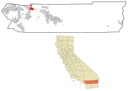
 Location in Riverside County and the state of California |
||
| Location in the United States | ||
| Coordinates: 33°55′54″N 116°53′51″W / 33.93167°N 116.89750°WCoordinates: 33°55′54″N 116°53′51″W / 33.93167°N 116.89750°W | ||
| Country |
|
|
| State |
|
|
| County | Riverside | |
| Incorporated | February 6, 1913 | |
| Area | ||
| • Total | 23.099 sq mi (59.826 km2) | |
| • Land | 23.099 sq mi (59.826 km2) | |
| • Water | 0 sq mi (0 km2) 0% | |
| Elevation | 2,349 ft (716 m) | |
| Population (April 1, 2010) | ||
| • Total | 29,603 | |
| • Estimate (2013) | 30,506 | |
| • Density | 1,300/sq mi (490/km2) | |
| Time zone | Pacific (UTC-8) | |
| • Summer (DST) | PDT (UTC-7) | |
| ZIP code | 92220 | |
| Area code | 951 | |
| FIPS code | 06-03820 | |
| GNIS feature IDs | 1660306, 2409785 | |
| Website | www |
|
Banning is a city in Riverside County, California, United States. The population was 29,603 at the 2010 census. It is situated in the San Gorgonio Pass, also known as Banning Pass. It is named for Phineas Banning, stagecoach line owner and the "Father of the Port of Los Angeles."
Banning has a western neighbor, the city of Beaumont, which shares geographic and regional features. Banning and Beaumont have been rapidly growing in size and population since the 1990s. Both cities are about 80 miles east of downtown Los Angeles and 30 miles west of Palm Springs, each connected by freeway and railroad.
The area, up to the mid-19th century, was inhabited by the Cahuilla people, though the region around Banning was originally Maringayam (Serrano), and the Cahuilla expanded into the pass only in historic times. In 1824 it became part of the Mission San Gabriel Arcangel, and then the Rancho San Gorgonio. The first Anglo to settle in the area was Dr. Isaac Smith in 1853. In 1863 a smallpox epidemic further diminished the Cahuilla. The government created Indian reservations for the Cahuilla in 1877.
The development of the settlement that was to become Banning coincided with the start of the Colorado River Gold Rush. The Bradshaw Trail was a wagon road to the gold boomtowns of Arizona Territory that passed through the area in 1862. Gilman's Ranch north of downtown served as a station for the stagecoach lines on this road. The railroad followed passing through the town in 1876. The Southern Pacific (later purchased by Union Pacific) railroad, was a major contributor to the area's growth. U.S. Route 99 was built in 1923, followed by U.S. Route 60/70 in 1936, and subsequently Interstate 10.
...
Wikipedia


