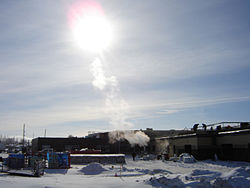
Blairmore SDA, Saskatoon, Saskatchewan
| Blairmore SDA | |
|---|---|

Blairmore Under Construction
|
|
| Coordinates: 52°07′38″N 106°44′52″W / 52.1273°N 106.7478°WCoordinates: 52°07′38″N 106°44′52″W / 52.1273°N 106.7478°W | |
| Country | Canada |
| Province | Saskatchewan |
| City | Saskatoon |
| Area | |
| • Water | 0 km2 (0 sq mi) 0% |
| Area code(s) | Area code 306 |
Blairmore Suburban Development Area (SDA) is an area in Saskatoon, Saskatchewan (Canada). It is a part of the west side community of Saskatoon. It lies (generally) north of the outskirts of the City and the Rural Municipality of Corman Park No. 344, west of downtown Saskatoon, and the Core Neighbourhoods SDA, south of the North West Industrial SDA, and west of the Confederation SDA. Most of the Blairmore SDA consists of undeveloped land annexed by the city in the mid-2000s. A total of nine neighbourhoods, primarily residential in nature, are ultimately planned for the SDA. As of 2013, two are in the process of development: the commercial/residential Blairmore Suburban Centre and the residential community Kensington.
The Blairmore Centre consists of a separate Bethlehem High School and public Tommy Douglas Collegiate as well as civic centre called The Shaw Centre. Blairmore SDA is home to the following schools:
In addition, the SDA contains the Yarrow Youth Farm, a provincial correctional facility for at-risk youth, which was annexed by the City.
22nd Street (Highway 14) is a major thoroughfare through Saskatoon Highway 14 connects with Asquith, Biggar Wilkie, Unity, and Macklin en route to Alberta. The area is also accessed by Highway 7, which links Saskatoon to Calgary, Alberta and the west coast, and Secondary Highway 684, also known as Dalmeny Road but officially renamed Neault Road in 2012, which was annexed by the city and provides a connection to Yellowhead Highway 16 and the town of Dalmeny.
...
Wikipedia
