Blanchard, Louisiana
| Blanchard, Louisiana | |
| Town | |
| Motto: "Reach out and grab your future...It's all in Blanchard" | |
| Country | United States |
|---|---|
| State | Louisiana |
| Parish | Caddo |
| Elevation | 223 ft (68.0 m) |
| Coordinates | 32°35′12″N 93°53′15″W / 32.58667°N 93.88750°WCoordinates: 32°35′12″N 93°53′15″W / 32.58667°N 93.88750°W |
| Area | 4.0 sq mi (10.4 km2) |
| - land | 4.0 sq mi (10 km2) |
| - water | 0.0 sq mi (0 km2) |
| Population | 2,899 (2010) |
| Density | 724.8/sq mi (279.8/km2) |
| Timezone | CST (UTC-6) |
| - summer (DST) | CDT (UTC-5) |
| Area code | 318 |
|
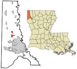
Location in Caddo Parish and the state of Louisiana.
|
|
|
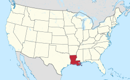
Location of Louisiana in the United States
|
|
|
Website: www |
|
Blanchard is a town in Caddo Parish, Louisiana, United States. The population was 2,899 at the 2010 census. It is part of the Shreveport–Bossier City Metropolitan Statistical Area.
Blanchard was likely named for Newton C. Blanchard, a United States Representative, Senator, and the 33rd Governor of Louisiana.
Blanchard is located at 32°35′12″N 93°53′15″W / 32.58667°N 93.88750°W (32.586762, -93.887590).Louisiana Highway 173 passes through the town as Main Street. Downtown Shreveport is 10 miles (16 km) to the southeast.
According to the United States Census Bureau, the town has a total area of 4.0 square miles (10.3 km2), all of it land.
As of the census of 2000, there were 2,682 people, 787 households, and 602 families residing in the town. The population density was 849.0 people per square mile (328.4/km²). There were 813 housing units at an average density of 336.7 per square mile (130.2/km²). The racial makeup of the town was 95.32% White, 2.93% African American, 0.54% Native American, 0.39% Asian, 0.10% Pacific Islander, 0.10% from other races, and 0.63% from two or more races. Hispanic or Latino of any race were 0.59% of the population.
...
Wikipedia


