Bloomfield, Connecticut
| Bloomfield | ||
|---|---|---|
| Town | ||

Capt. Oliver Filley House
|
||
|
||
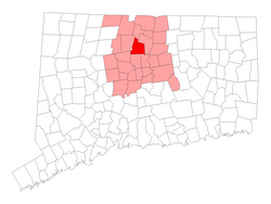
 Location within Hartford County, Connecticut |
||
| Coordinates: 41°51′N 72°44′W / 41.850°N 72.733°WCoordinates: 41°51′N 72°44′W / 41.850°N 72.733°W | ||
| Country | United States | |
| State | Connecticut | |
| NECTA | Hartford | |
| Region | Capitol Region | |
| Incorporated | 1835 | |
| Government | ||
| • Type | Council-manager | |
| • Town manager | Philip Schenck | |
| • Town council | Sydney T. Schulman (D), Mayor Joan A. Gamble (D), Deputy Mayor Wayne Hypolite (D) Derrick Seldon (D) Patrick DeLorenzo (R) Leon Rivers (D) Joel Neuwirth (R) Joseph Merritt (R) Joe Washington (D) |
|
| Area | ||
| • Total | 26.3 sq mi (68.0 km2) | |
| • Land | 26.1 sq mi (67.6 km2) | |
| • Water | 0.2 sq mi (0.4 km2) | |
| Elevation | 138 ft (42 m) | |
| Population (2010) | ||
| • Total | 20,486 | |
| • Density | 780/sq mi (300/km2) | |
| Time zone | EST (UTC-5) | |
| • Summer (DST) | EDT (UTC-4) | |
| ZIP code | 06002 | |
| Area code(s) | 860 | |
| FIPS code | 09-05910 | |
| GNIS feature ID | 0213392 | |
| Website | www |
|
Bloomfield is a town in Hartford County, Connecticut, United States. The population was 20,486 at the 2010 census.
Originally land of the Poquonocks, the area was first settled in 1660 as part of Windsor, organized as the Parish of Wintonbury in 1736. Wintonbury comes from three names from neighboring towns Windsor, Farmington , and Simsbury. It was finally incorporated as the town of Bloomfield in May 1835. Initially, the town's local economy was agriculturally based, mostly in shade tobacco, remaining as such until it developed as a postwar suburb of Hartford starting in the 1950s. Today, Bloomfield's local character varies. While the town's southern and eastern fringes are more densely populated and developed, the northern and western sections maintain a more rural feel with meadows, woods, and some remaining farmland.
According to the United States Census Bureau, the town has a total area of 26.3 square miles (68.0 km2), of which 26.1 square miles (67.6 km2) is land and 0.15 square miles (0.4 km2), or 0.63%, is water.
Bloomfield is bordered by Windsor to the northeast, East Granby to the north, Simsbury and Avon to the west, and West Hartford and Hartford to the south.
The northern border of Bloomfield is formed by the Farmington River. The west side of the town is flanked by Talcott Mountain, part of the Metacomet Ridge, a mountainous trap rock ridgeline that stretches from Long Island Sound to nearly the Vermont border. Notable features of the Metacomet Ridge in Bloomfield include Penwood State Park and the Tariffville Gorge of the Farmington River, on the borders of East Granby, Simsbury, and Bloomfield. The 51-mile (82 km) Metacomet Trail traverses the ridge.
...
Wikipedia

