Brighton Kemptown
| Brighton, Kemptown | |
|---|---|
|
Borough constituency for the House of Commons |
|

Boundary of Brighton, Kemptown in East Sussex.
|
|

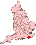
Location of East Sussex within England.
|
|
| County | East Sussex |
| Population | 91,567 (2011 census) |
| Electorate | 66,557 (December 2010) |
| Current constituency | |
| Created | 1950 |
| Member of parliament | Simon Kirby (Conservative) |
| Number of members | One |
| Created from | Brighton |
| Overlaps | |
| European Parliament constituency | South East England |
Coordinates: 50°49′26″N 0°02′06″W / 50.824°N 0.035°W
Brighton Kemptown is a constituency in the House of Commons of the UK Parliament covering the eastern portion of the city of Brighton and Hove including Kemptown and part of the Lewes District, represented since 2010 by Simon Kirby of the Conservative Party.
1950-1983: The County Borough of Brighton wards of Elm Grove, Hanover, King's Cliff, Lewes Road, Moulsecoomb, Pier, Queen's Park, Rottingdean, and St John's.
1983-1997: The Borough of Brighton wards of Hanover, King's Cliff, Marine, Moulsecoomb, Queen's Park, Rottingdean, Tenantry, and Woodingdean.
1997-2010: The Borough of Brighton wards of King's Cliff, Marine, Moulsecoomb, Queen's Park, Rottingdean, Tenantry, and Woodingdean, and the District of Lewes wards of East Saltdean, Peacehaven East, Peacehaven North, Peacehaven West, and Telscombe Cliffs.
2010-present: The City of Brighton and Hove wards of East Brighton, Moulsecoomb and Bevendean, Queen's Park, Rottingdean Coastal, and Woodingdean, and the District of Lewes wards of East Saltdean and Telscombe Cliffs, Peacehaven East, Peacehaven North, and Peacehaven West.
In most recent general elections it has been a marginal seat between the Labour and the Conservative parties.
...
Wikipedia
