Cairo, Nebraska
| Cairo, Nebraska | |
|---|---|
| Village | |

Welcome sign on Nebraska Highway 11 at northern edge of Cairo
|
|
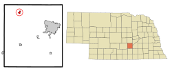
 Location of Cairo, Nebraska |
|
| Coordinates: 41°0′1″N 98°36′29″W / 41.00028°N 98.60806°WCoordinates: 41°0′1″N 98°36′29″W / 41.00028°N 98.60806°W | |
| Country | United States |
| State | Nebraska |
| County | Hall |
| Area | |
| • Total | 0.77 sq mi (1.99 km2) |
| • Land | 0.77 sq mi (1.99 km2) |
| • Water | 0 sq mi (0 km2) |
| Elevation | 1,952 ft (595 m) |
| Population (2010) | |
| • Total | 785 |
| • Estimate (2016) | 804 |
| • Density | 1,000/sq mi (390/km2) |
| Time zone | Central (CST) (UTC-6) |
| • Summer (DST) | CDT (UTC-5) |
| ZIP code | 68824 |
| Area code(s) | 308 |
| FIPS code | 31-07625 |
| GNIS feature ID | 0827842 |
Cairo (/ˈkɛəroʊ/ KARE-row, not /ˈkaɪəroʊ/ KYE-row) is a village in Hall County, Nebraska, United States. The population was 785 at the 2010 census. It is part of the Grand Island, Nebraska Micropolitan Statistical Area.
Cairo was established in 1886 when the Grand Island and Wyoming Central Railroad was extended to that point. It was named after Cairo, the capital of Egypt. Many of the town's street names reinforce the "Egyptian" theme.
Cairo was incorporated as a village in 1892.
Cairo is located at 41°00′01″N 98°36′29″W / 41.000409°N 98.608083°W (41.000409, -98.608083).
...
Wikipedia
