California and Oregon Railroad

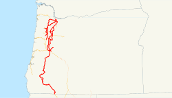
Oregon and California Railroad (red) and Southern Pacific system (orange) as of 1918
|
|
| Locale | Portland, Oregon via California |
|---|---|
| Dates of operation | 1869–1927 |
| Successor | Southern Pacific |
| Track gauge | 4 ft 8 1⁄2 in (1,435 mm) standard gauge |
The Oregon and California Railroad was formed from the Oregon Central Railroad when it was the first to operate a 20-mile (32 km) stretch south of Portland in 1869. This qualified the Railroad for land grants in California, whereupon the name of the railroad soon changed to Oregon & California Rail Road Company. In 1887, the line was completed over Siskiyou Summit, and the Southern Pacific Railroad assumed control of the railroad, although it was not officially sold to Southern Pacific until January 3, 1927.
As part of the U.S. government's desire to foster settlement and economic development in the western states, in July 1866, Congress passed the Oregon and California Railroad Act, which made 3,700,000 acres (1,500,000 ha) of land available for a company that built a railroad from Portland, Oregon to San Francisco, distributed by the state of Oregon in 12,800-acre (5,200 ha) land grants for each mile of track completed. Two companies, both of which named themselves the Oregon Central Railroad, began a competition to build the railroad, one on the west side of the Willamette River and one on the east side. The two lines would eventually merge and reorganize as the Oregon and California Railroad.
In 1869, Congress changed how the grants were to be distributed, requiring the railroads to sell land along the line to settlers in 160-acre (65 ha) parcels at $2.50 per acre. The purpose of these restrictions was to encourage settlement and economic development, while compensating the O&C Railroad for its costs of construction. Construction efforts were sporadic, finally reaching completion in 1887 after the financially troubled O&C Railroad was acquired by the Southern Pacific. The land was distributed in a checkerboard pattern, with sections laid out for 20 miles (32 km) on either side of the rail corridor with the government retaining the alternate sections for future growth.
...
Wikipedia
