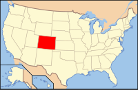
Chaffee County, Colorado
| Chaffee County, Colorado | |
|---|---|
 Location in the U.S. state of Colorado |
|
 Colorado's location in the U.S. |
|
| Founded | February 10, 1879 |
| Named for | Jerome B. Chaffee |
| Seat | Salida |
| Largest city | Salida |
| Area | |
| • Total | 1,015 sq mi (2,629 km2) |
| • Land | 1,013 sq mi (2,624 km2) |
| • Water | 1.6 sq mi (4 km2), 0.2% |
| Population (est.) | |
| • (2015) | 18,658 |
| • Density | 18/sq mi (7/km²) |
| Congressional district | 5th |
| Time zone | Mountain: UTC-7/-6 |
| Website | www |
Chaffee County is one of the 64 counties of the U.S. state of Colorado. As of the 2010 census, the population was 17,809. The county seat is Salida.
Chaffee County has a confusing origin. Between February 8 and February 10, 1879, Carbonate County was created by the Colorado legislature out of northern Lake County. On February 10 the two counties were renamed, with the southern part of Lake County becoming Chaffee County, and Carbonate County becoming Lake County. Chaffee County is known as the “Heart of the Rockies”. It was named for Jerome B. Chaffee, Colorado's first United States Senator.
According to the U.S. Census Bureau, the county has a total area of 1,015 square miles (2,630 km2), of which 1,013 square miles (2,620 km2) is land and 1.6 square miles (4.1 km2) (0.2%) is water.
As of the census of 2000, there were 16,242 people, 6,584 households, and 4,365 families residing in the county. The population density was 16 people per square mile (6/km²). There were 8,392 housing units at an average density of 8 per square mile (3/km²). The racial makeup of the county was 90.94% White, 1.58% Black or African American, 1.09% Native American, 0.44% Asian, 0.05% Pacific Islander, 4.21% from other races, and 1.69% from two or more races. 8.58% of the population were Hispanic or Latino of any race.
...
Wikipedia
