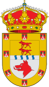
Chantada
| Chantada | ||
|---|---|---|
| Municipality | ||
|
||
| Location in Spain | ||
| Coordinates: 42°37′N 7°46′W / 42.617°N 7.767°W | ||
| Country | Spain | |
| Autonomous community | Galicia | |
| Province | Lugo | |
| Comarca | Chantada | |
| Government | ||
| • Mayor | Manuel Lorenzo Varela Rodríguez (Independentes Terras do Asma) | |
| Area | ||
| • Total | 176.7 km2 (68.2 sq mi) | |
| Elevation | 36 m (118 ft) | |
| Population (2015) | ||
| • Total | 8,493 | |
| • Density | 48/km2 (120/sq mi) | |
| Demonym(s) | Chantadinos | |
| Time zone | CET (UTC+1) | |
| • Summer (DST) | CEST (UTC+2) | |
| Postal code | 27500 | |
| Website | Official website | |
Chantada, is a municipality in the province of Lugo, Galicia, Spain.
Chantada is situated on the left bank of the Río Asma, a small right-hand tributary of the Minho river, and on the main road from Ourense, 29 km S. by W., to Lugo, 45 km N. by E. Chantada is the chief town of the fertile region between the Minho and the heights of El Faro, which mark the western border of the province. Despite the lack of railway communication, it has a thriving trade in grain, flax, hemp, and dairy produce.
...
Wikipedia


