
Charette, Isère
| Charette | |
|---|---|
| Commune | |
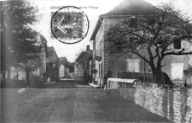
The road into Charette in 1907
|
|

Charette
Location within Auvergne-Rhône-Alpes region

Charette
|
|
| Coordinates: 45°48′40″N 5°22′15″E / 45.8111°N 5.3708°ECoordinates: 45°48′40″N 5°22′15″E / 45.8111°N 5.3708°E | |
| Country | France |
| Region | Auvergne-Rhône-Alpes |
| Department | Isère |
| Arrondissement | La Tour-du-Pin |
| Canton | Morestel |
| Intercommunality | Pays des Couleurs |
| Government | |
| • Mayor (2014–2020) | Hervé Courtejaire |
| Area1 | 11.26 km2 (4.35 sq mi) |
| Population (2009)2 | 436 |
| • Density | 39/km2 (100/sq mi) |
| Time zone | CET (UTC+1) |
| • Summer (DST) | CEST (UTC+2) |
| INSEE/Postal code | 38083 /38390 |
| Elevation | 240–350 m (790–1,150 ft) (avg. 248 m or 814 ft) |
|
1 French Land Register data, which excludes lakes, ponds, glaciers > 1 km2 (0.386 sq mi or 247 acres) and river estuaries. 2Population without double counting: residents of multiple communes (e.g., students and military personnel) only counted once. |
|
1 French Land Register data, which excludes lakes, ponds, glaciers > 1 km2 (0.386 sq mi or 247 acres) and river estuaries.
Charette is a commune in the Isère department in southeastern France.
...
Wikipedia