Cherrapunji
|
Sohra Sohra Cherrapunji |
|
|---|---|
| town | |

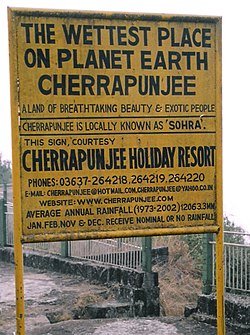
Cherrapunji has held the record for highest rainfall multiple times in the past
|
|
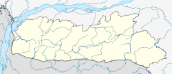
| Location in Meghalaya, India | |
| Coordinates: 25°18′N 91°42′E / 25.3°N 91.7°ECoordinates: 25°18′N 91°42′E / 25.3°N 91.7°E | |
| Country |
|
| State | Meghalaya |
| District | East Khasi Hills |
| Elevation | 1,484 m (4,869 ft) |
| Population (2011) | |
| • Total | 14,816 |
| • Density | 397/km2 (1,030/sq mi) |
| Languages | |
| • Official | Khasi, English |
| Time zone | IST (UTC+5:30) |
| Telephone code | 03637 |
| Precipitation | 11,777 millimetres (463.7 in) |
| Climate | Cwb |
| Website | http://cherrapunjee.gov.in/ |
| Cherrapunji, India | ||||||||||||||||||||||||||||||||||||||||||||||||||||||||||||
|---|---|---|---|---|---|---|---|---|---|---|---|---|---|---|---|---|---|---|---|---|---|---|---|---|---|---|---|---|---|---|---|---|---|---|---|---|---|---|---|---|---|---|---|---|---|---|---|---|---|---|---|---|---|---|---|---|---|---|---|---|
| Climate chart () | ||||||||||||||||||||||||||||||||||||||||||||||||||||||||||||
|
||||||||||||||||||||||||||||||||||||||||||||||||||||||||||||
|
||||||||||||||||||||||||||||||||||||||||||||||||||||||||||||
| J | F | M | A | M | J | J | A | S | O | N | D |
|
11
16
7
|
46
17
9
|
240
21
13
|
938
22
15
|
1214
22
16
|
2294
23
18
|
3272
22
18
|
1760
23
18
|
1352
23
18
|
549
23
16
|
72
20
12
|
29
17
8
|
| Average max. and min. temperatures in °C | |||||||||||
| Precipitation totals in mm | |||||||||||
| Source: NOAA | |||||||||||
| Imperial conversion | |||||||||||
|---|---|---|---|---|---|---|---|---|---|---|---|
| J | F | M | A | M | J | J | A | S | O | N | D |
|
0.4
60
45
|
1.8
63
48
|
9.4
69
55
|
37
71
58
|
48
72
61
|
90
73
64
|
129
72
65
|
69
73
65
|
53
73
Wikipedia
...
| |||


