Cheyenne Municipal Airport
|
Cheyenne Regional Airport Jerry Olson Field |
|||||||||||||||
|---|---|---|---|---|---|---|---|---|---|---|---|---|---|---|---|
| Summary | |||||||||||||||
| Airport type | Public/Military | ||||||||||||||
| Owner | Cheyenne Regional Airport Board | ||||||||||||||
| Serves | Cheyenne, Wyoming | ||||||||||||||
| Elevation AMSL | 6,160 ft / 1,878 m | ||||||||||||||
| Website | www.CheyenneAirport.com | ||||||||||||||
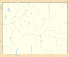
| Map | |||||||||||||||
| Location of airport in Wyoming / United States | |||||||||||||||
| Runways | |||||||||||||||
|
|||||||||||||||
| Statistics (2015) | |||||||||||||||
|
|||||||||||||||
|
Sources: airport web site and FAA
|
|||||||||||||||
| Aircraft operations | 43,928 |
|---|---|
| Based aircraft | 88 |
Coordinates: 41°09′20″N 104°48′38″W / 41.15556°N 104.81056°W
Cheyenne Regional Airport (IATA: CYS, ICAO: KCYS, FAA LID: CYS) (Jerry Olson Field) is a civil-military airport a mile north of downtown Cheyenne, in Laramie County, Wyoming. The Cheyenne Regional Airport Board owns it.
Cheyenne Regional Airport is the home of Cheyenne Air National Guard Base, the main operating base for the Wyoming Air National Guard (WyANG) and the Wyoming Army National Guard (WARNG).
The U.S. Post Office gave Cheyenne's aviation its first boost. With the introduction of airmail routes after World War I, the Cheyenne civic leaders lobbied to establish Cheyenne as a stop. Buck Heffron piloted the first air mail flight destined for Salt Lake City on September 9, 1920. Heffron flew a DH-4 that could barely get high enough to clear the mountains and had a maximum speed of 100 mph (160 km/h). The pilot was one of the brave aviators who was guided by a few instruments, maps and landmarks.
Cheyenne's airport saw its first paying passengers in the 1920s. The first was Elizabeth Brown, a female barber. She enjoyed a ride with World War I pilot, C.A. McKenzie, in a Curtis Oriole biplane. With the step up to the DC-3 in 1937 passengers enjoyed greater comfort and safety. Soon United DC-3s were flying Cheyenne passengers to both coasts and south to Denver.
...
Wikipedia


