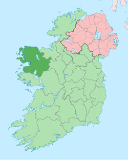
Co. Mayo
|
County Mayo Contae Mhaigh Eo
|
||
|---|---|---|
|
||
| Motto: Dia is Muire Linn (Irish) "God and Mary be with us" |
||
 |
||
| Country | Ireland | |
| Province | Connacht | |
| Dáil Éireann | Mayo | |
| EU Parliament | Midlands–North-West | |
| County town |
|
|
| Government | ||
| • Type | County Council | |
| Area | ||
| • Total | 5,586 km2 (2,157 sq mi) | |
| Area rank | 3rd | |
| Population (2011) | 130,638 | |
| • Rank | 17th | |
| Vehicle index mark code |
MO | |
| Website | www |
|
County Mayo (Irish: Contae Mhaigh Eo, meaning "Plain of the yew trees") is a county in Ireland. In the West of Ireland, it is part of the province of Connacht and is named after the village of Mayo, now generally known as Mayo Abbey. Mayo County Council is the local authority for the county. The population of the county was 130,638 at the 2011 census. The boundaries of the county, which was formed in 1585, reflect the Mac William Íochtar lordship at that time.
It is bounded on the north and west by the Atlantic Ocean; to the south by County Galway; the east by County Roscommon; and the northeast by County Sligo. Mayo is the third-largest of Ireland's 32 counties in area and 15th largest in terms of population. It is the second-largest of Connacht’s five counties in both size and population. There is a distinct geological difference between the west and the east of the county. The west consists largely of poor subsoils and is covered with large areas of extensive Atlantic blanket bog, whereas the east is largely a limestone landscape. Agricultural land is therefore more productive in the east than in the west.
Mayo County Council (Irish: Comhairle Contae Mhaigh Eo) is the authority responsible for local government. As a county council, it is governed by the Local Government Act 2001. The County is divided into four municipal areas Castlebar, Ballina, Claremorris and West (an area which stretches from Westport to Belmullet). The council is responsible for housing and community, roads and transportation, urban planning and development, amenity and culture, and environment. For the purpose of local elections the county is divided into its four municipal districts, replacing the former six local electoral areas: Ballina (6), Belmullet (4), Castlebar (7), Claremorris (6), Swinford (4) and Westport (4). The county town is at Áras an Contae in Castlebar the main population centre located in the centre of the county. For national elections half of the Claremorris Municipal District is in Galway West and stretches from Ashford Castle to Ireland West Airport.
...
Wikipedia

