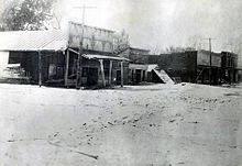
Columbus, Kentucky
| Columbus, Kentucky | |
|---|---|
| City | |
| Motto: | |
 Location of Columbus, Kentucky |
|
| Coordinates: 36°45′37″N 89°6′10″W / 36.76028°N 89.10278°WCoordinates: 36°45′37″N 89°6′10″W / 36.76028°N 89.10278°W | |
| Country | United States |
| State | Kentucky |
| County | Hickman |
| Area | |
| • Total | 0.4 sq mi (1.1 km2) |
| • Land | 0.4 sq mi (1.1 km2) |
| • Water | 0.0 sq mi (0.0 km2) |
| Elevation | 459 ft (140 m) |
| Population (2000) | |
| • Total | 229 |
| • Density | 558.6/sq mi (215.7/km2) |
| Time zone | Central (CST) (UTC-6) |
| • Summer (DST) | CDT (UTC-5) |
| ZIP code | 42032 |
| Area code(s) | 270 & 364 |
| FIPS code | 21-16768 |
| GNIS feature ID | 0489887 |
Columbus is a home rule-class city in Hickman County, Kentucky, in the United States. The population was 170 at the 2010 census, a decline from 229 in 2000.
Columbus is the oldest town in Kentucky's Jackson Purchase. It was first settled on the Mississippi floodplain in 1804 and known as Iron Banks after the site's French name les rivages de fer. The long-held local rumor that President Thomas Jefferson planned to remove the American capital to the site has absolutely no basis in fact.
The name of the town was changed to Columbus (in honor of the Italian explorer) in 1820, the year the town received its first post office and its formal establishment by the state assembly. It was the original county seat of Hickman before the transfer of the court to Clinton. It was formally incorporated in 1860, just ahead of its seizure by Confederate forces (including the Louisiana "Shreveport Rebels") during the American Civil War the next year. The Columbus-Belmont State Park commemorates the Confederate general Leonidas Polk's attempt to maintain a large anchor chain across the entire Mississippi at Columbus, then the northernmost spur on the Mobile and Ohio Railroad, as well as the Union response, General Ulysses S Grant's victory at Belmont on the Missouri shore. The engagement was Grant's first direct combat during the war.
...
Wikipedia


