Conley, Georgia
| Conley, Georgia | |
|---|---|
| Census-designated place | |
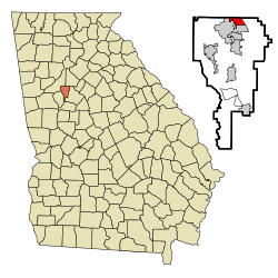
 Location in Clayton County and the state of Georgia |
|
| Coordinates: 33°38′25″N 84°20′32″W / 33.64028°N 84.34222°WCoordinates: 33°38′25″N 84°20′32″W / 33.64028°N 84.34222°W | |
| Country | United States |
| State | Georgia |
| County | Clayton |
| Area | |
| • Total | 1.94 sq mi (5.03 km2) |
| • Land | 1.92 sq mi (4.98 km2) |
| • Water | 0.02 sq mi (0.05 km2) |
| Elevation | 853 ft (260 m) |
| Population (2010) | |
| • Total | 6,228 |
| • Density | 3,241/sq mi (1,251.5/km2) |
| Time zone | Eastern (EST) (UTC-5) |
| • Summer (DST) | EDT (UTC-4) |
| ZIP code | 30288 |
| Area code(s) | 404 |
| FIPS code | 13-19280 |
| GNIS feature ID | 0331447 |
Conley is a census-designated place (CDP) in Clayton County, Georgia, United States. The population was 6,228 at the 2010 census. The source of the name of the community is unknown, though a pioneer settlement family of the surname "" lived in DeKalb County (1850 census).
Conley is located along the northern border of Clayton County at 33°38′25″N 84°20′32″W / 33.64028°N 84.34222°W (33.640142, -84.342255). It is bordered by the city of Forest Park to the south and west, the city of Atlanta to the northwest, and by unincorporated land in DeKalb County to the north. The eastern edge of the CDP is formed by U.S. Route 23 (Moreland Avenue). Fort Gillem is to the south in Forest Park.
According to the United States Census Bureau, the Conley CDP has a total area of 1.9 square miles (5.0 km2), of which 0.019 square miles (0.05 km2), or 0.98%, is water.
As of the census of 2000, there were 6,188 people, 1,968 households, and 1,505 families residing in the CDP. The population density was 3,234.2 people per square mile (1,250.9/km²). There were 2,053 housing units at an average density of 1,073.0/sq mi (415.0/km²). The racial makeup of the CDP was 34.34% White, 52.86% African American, 0.31% Native American, 4.75% Asian, 0.26% Pacific Islander, 6.06% from other races, and 1.42% from two or more races. Hispanic or Latino of any race were 10.46% of the population.
...
Wikipedia
