Correvon
| Correvon | ||
|---|---|---|
| Former municipality of Switzerland | ||
 |
||
|
||
| Coordinates: 46°43′N 6°44′E / 46.717°N 6.733°ECoordinates: 46°43′N 6°44′E / 46.717°N 6.733°E | ||
| Country | Switzerland | |
| Canton | Vaud | |
| District | Gros-de-Vaud | |
| Area | ||
| • Total | 2.24 km2 (0.86 sq mi) | |
| Elevation | 752 m (2,467 ft) | |
| Population (2011) | ||
| • Total | 106 | |
| • Density | 47/km2 (120/sq mi) | |
| Postal code | 1410 | |
| SFOS number | 5667 | |
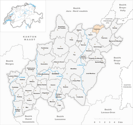
| Surrounded by | Bioley-Magnoux, Chanéaz, Ogens, Thierrens, Vuissens (FR) | |
| Website | Profile (French), SFSO statistics |
|
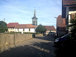
Correvon is a former municipality in the district of Gros-de-Vaud in the canton of Vaud in Switzerland. The municipalities of Chapelle-sur-Moudon, Correvon, Denezy, Martherenges, Neyruz-sur-Moudon, Peyres-Possens, Saint-Cierges, Thierrens and Chanéaz merged on 1 January 2013 into the new municipality of Montanaire.
Correvon is first mentioned in 1166 as Correuont.
Correvon had an area, as of 2009[update], of 2.2 square kilometers (0.85 sq mi). Of this area, 1.86 km2 (0.72 sq mi) or 83.0% is used for agricultural purposes, while 0.28 km2 (0.11 sq mi) or 12.5% is forested. Of the rest of the land, 0.05 km2 (12 acres) or 2.2% is settled (buildings or roads).
Of the built up area, housing and buildings made up 1.3% and transportation infrastructure made up 0.4%. Out of the forested land, all of the forested land area is covered with heavy forests. Of the agricultural land, 68.3% is used for growing crops and 14.3% is pastures.
The former municipality was part of the Moudon District until it was dissolved on 31 August 2006, and Correvon became part of the new district of Gros-de-Vaud.
The former municipality is located on a plateau between the Broye and Mentue rivers.
The blazon of the municipal coat of arms is Tierced per fess base per pale, 1. Azure a cross Or; 2. Quartered Azure and Or, overall a flory Staff bendwise of the second; 3. Azure, a Wing sinister Or.
...
Wikipedia


