De Soto, Kansas
| De Soto, Kansas | ||
|---|---|---|
| City | ||

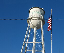
Downtown Water Tower (2017)
|
||
|
||
 Location within Johnson County and Kansas |
||
 KDOT map of Johnson County (legend) |
||
| Coordinates: 38°57′54″N 94°57′44″W / 38.96500°N 94.96222°WCoordinates: 38°57′54″N 94°57′44″W / 38.96500°N 94.96222°W | ||
| Country | United States | |
| State | Kansas | |
| Counties | Johnson, Leavenworth | |
| Township | Lexington Township | |
| Settlement | 1828 | |
| Municipal Territory | 1857 | |
| Incorporated | 1901 | |
| Government | ||
| • Type | Mayor–Council | |
| • Mayor | Timothy Maniez | |
| • City Clerk | Lana McPherson | |
| Area | ||
| • Total | 11.20 sq mi (29.01 km2) | |
| • Land | 11.07 sq mi (28.67 km2) | |
| • Water | 0.13 sq mi (0.34 km2) | |
| Elevation | 860 ft (262 m) | |
| Population (2010) | ||
| • Total | 5,720 | |
| • Estimate (2015) | 6,074 | |
| • Density | 510/sq mi (200/km2) | |
| Time zone | CST (UTC-6) | |
| • Summer (DST) | CDT (UTC-5) | |
| ZIP codes | 66018-66019 | |
| Area code | 913 | |
| FIPS code | 20-17850 | |
| GNIS ID | 0479178 | |
| Website | desotoks.us | |
De Soto /dəˈsoʊtoʊ/ is a city in Johnson and Leavenworth counties in the U.S. state of Kansas, and part of the Kansas City Metropolitan Area. The vast majority of the city, 11.13 sq. mi., lies within Johnson County. As of the 2010 census, the city population was 5,720, and the 2015 census estimate is 6,074. The area code is 913, and the two zip codes are 66018 and 66019.
De Soto began in the spring of 1857, named for sixteenth-century Spanish explorer, Hernando De Soto. In 1858, John Possum, a Shawnee Indian, and Hattie Possum sold 80 acres to John F. Legate, S. Todd and Stratton and Williams for $1,200. The next sale was 80 acres to the De Soto Town Company in July 1861 for $1,176. Major James B. Abbott is remembered as one of the town's pioneer landowners and the builder of Abbot Hall. Today, Abbot Hall is one of two town museums.
With the construction of the 9,080 acre Sunflower Army Ammunition Plant south of De Soto, De Soto's population boomed in the early 1940s during WWII. In May 1943, The Kansas City Star article reported "a town rapidly growing, with a population increase from 400 to 1,000 persons in under a year". This sudden overflow in population put a great strain on housing and other resources in the city; however, many original residents prospered during this time, buying property and starting new businesses. Production flowed steadily at the Sunflower Army Ammunition Plant until the plant went on standby in March 1948, with small scale production following shortly after until its closure in 1993.
In mid-July 1951, heavy rains led to a great rise of water in the Kansas River and other surrounding areas of the central United States, known as the Great Flood of 1951. De Soto, being along the Kansas River, was severely damaged. The river crest at De Soto was recorded at 24.87 feet (7.58 m). Most of the downtown area was completely flooded, with over 2 feet of standing water in some places.
...
Wikipedia

