Denton, MD
| Denton, Maryland | ||
|---|---|---|
| Town | ||
| Town of Denton | ||

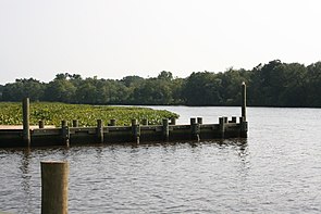
The Choptank River in July 2008
|
||
|
||
| Motto: "The Garden of America" | ||
 Location in Caroline County and the state of Maryland |
||
| Location within the state of Maryland | ||
| Coordinates: 38°53′2″N 75°49′36″W / 38.88389°N 75.82667°WCoordinates: 38°53′2″N 75°49′36″W / 38.88389°N 75.82667°W | ||
| Country | ||
| State |
|
|
| County |
|
|
| Government | ||
| • Mayor | Dennis Porter | |
| • Town Admin. | Donald Mulrine | |
| Area | ||
| • Total | 5.50 sq mi (14.24 km2) | |
| • Land | 5.28 sq mi (13.68 km2) | |
| • Water | 0.22 sq mi (0.57 km2) | |
| Elevation | 43 ft (13 m) | |
| Population (2010) | ||
| • Total | 4,418 | |
| • Estimate (2012) | 4,372 | |
| • Density | 836.7/sq mi (323.1/km2) | |
| Time zone | Eastern (EST) (UTC-5) | |
| • Summer (DST) | EDT (UTC-4) | |
| ZIP code | 21629 | |
| Area code(s) | 410 | |
| FIPS code | 24-22725 | |
| GNIS feature ID | 0590087 | |
| Website | www |
|
Denton is a town in Caroline County, Maryland. The population of Denton was 4,418 as of the 2010 United States Census, and it is the county seat of Caroline County.
Denton was established in 1781. It was first called Eden Town, for Sir Robert Eden, the last royal governor of Maryland, and over time Eden Town was shortened to Denton. The town was incorporated in 1802.
Denton is located at 38°53′2″N 75°49′36″W / 38.88389°N 75.82667°W (38.883853, -75.826556).
According to the United States Census Bureau, the town has a total area of 5.50 square miles (14.24 km2), of which, 5.28 square miles (13.68 km2) is land and 0.22 square miles (0.57 km2) is water.
The climate in this area is characterized by hot, humid summers and generally mild to cool winters. According to the Köppen Climate Classification system, Denton has a humid subtropical climate, abbreviated "Cfa" on climate maps.
As of the census of 2010, there were 4,418 people, 1,606 households, and 1,034 families residing in the town. The population density was 836.7 inhabitants per square mile (323.1/km2). There were 1,791 housing units at an average density of 339.2 per square mile (131.0/km2). The racial makeup of the town was 71.8% White, 22.9% African American, 0.4% Native American, 0.6% Asian, 1.0% from other races, and 3.1% from two or more races. Hispanic or Latino of any race were 3.3% of the population.
...
Wikipedia


