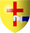
Donegal
|
Donegal Dún na nGall
|
||
|---|---|---|
| Town | ||

Donegal Town
|
||
|
||
| Location in Ireland | ||
| Coordinates: 54°39′00″N 8°07′01″W / 54.650°N 8.117°WCoordinates: 54°39′00″N 8°07′01″W / 54.650°N 8.117°W | ||
| Country | Ireland | |
| Province | Ulster | |
| County | County Donegal | |
| Dáil Éireann | Donegal South-West | |
| Elevation | 32 m (105 ft) | |
| Population (2011) | ||
| • Urban | 2,607 | |
| Irish Grid Reference | G924789 | |
| Dialing code | +353 74 | |
| Website | www |
|
Donegal or Donegal Town (/ˈdʌniɡɔːl/ or /ˈdʌnᵻɡɔːl/ DUN-i-gawl; Irish: Dún na nGall, meaning "fort of the foreigners") is a town in County Donegal, Republic of Ireland. The name was historically written in English as 'Dunnagall' or 'Dunagall'. Donegal gave its name to County Donegal, although Lifford is now the county town. Until the early 17th century, Donegal was the 'capital' of Tyrconnell (Irish: Tír Chonaill), a Gaelic kingdom controlled by the O'Donnell dynasty of the Northern Uí Néill. Donegal sits at the mouth of the River Eske and Donegal Bay, which is overshadowed by the Blue Stack Mountains ('the Croaghs'). The town is bypassed by the N15 and N56 roads. The centre of the town, known as The Diamond, is a hub for music, poetic and cultural gatherings in the area.
...
Wikipedia


