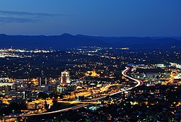
Downtown Roanoke, Virginia
| Downtown | |
| Roanoke Neighborhood | |
|
Downtown from the Mill Mountain Star overlook
|
|
| Country | United States |
|---|---|
| State | Virginia |
| City | Roanoke |
| Elevation | 925 ft (282 m) |
| Coordinates | 37°16′19″N 79°56′21″W / 37.27194°N 79.93917°WCoordinates: 37°16′19″N 79°56′21″W / 37.27194°N 79.93917°W |
| Timezone | EST (UTC-5) |
| - summer (DST) | EDT (UTC-4) |
| ZIP Codes | 24011 |
| Area code | 540 |
Downtown is the central business district of Roanoke, Virginia, United States. Located geographically at the center of the city, Downtown began its development with the completion of the Shenandoah Valley Railroad in 1882. Today the Downtown core is noted as the center of business for the Roanoke Valley, the Roanoke City Market, the Roanoke Downtown Historic District and many other attractions and amenities.
Geographically, downtown Roanoke is defined by the city as the area bound by Interstate 581 on the east, 5th Street to the west, the Norfolk and Western railroad tracks to the north and Day Avenue to the south. This area is the location of the central core and the historic Market District. An additional section of downtown is located south of Day Avenue, bound to the east by the Roy L. Webber Expressway, South Jefferson Street to the west and Albemarle Avenue to the south. This area is the location of the former Carilion Community Hospital and the Jefferson College of Health Sciences.
Downtown borders the neighborhoods of the West End on the west, Belmont on the east, Gainsboro on the north and both Old Southwest and South Jefferson on the south.
...
Wikipedia

