Drag River
| Drag River | |
| River | |
| Country | Canada |
|---|---|
| Province | Ontario |
| Region | Southern Ontario |
| County | Haliburton |
| Municipalities | Minden Hills, Dysart et al |
| Part of | Great Lakes Basin |
| Source | Unnamed lake |
| - location | Dysart et al |
| - elevation | 389 m (1,276 ft) |
| - coordinates | 45°05′10″N 78°20′18″W / 45.08611°N 78.33833°W |
| Mouth | Burnt River |
| - location | Minden Hills |
| - elevation | 299 m (981 ft) |
| - coordinates | 44°53′21″N 78°37′00″W / 44.88917°N 78.61667°WCoordinates: 44°53′21″N 78°37′00″W / 44.88917°N 78.61667°W |
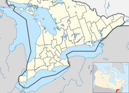
The Drag River is a river in the municipalities of Minden Hills and Dysart et al in Haliburton County, Southern Ontario, Canada. It is in the Great Lakes Basin and is a right tributary of the Burnt River.
The river begins at an unnamed lake, and flows west through Drag Lake, Head Lake and Grass Lake, then heads south through Kashagawigamog Lake to reach its mouth at the Burnt River, about 1 kilometre (0.6 mi) south of the community of Gelert. The Burnt River flows Kawartha Lakes and the Trent River to Lake Ontario.
Other map sources:
...
Wikipedia

