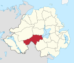
Dungannon and South Tyrone
| Dungannon and South Tyrone Borough Council | |
|---|---|
 |
|
| Area | 315 km2 (122 sq mi) Ranked 5th of 26 |
| District HQ | Dungannon |
| Catholic | 64.1% |
| Protestant | 33% |
| Country | Northern Ireland |
| Sovereign state | United Kingdom |
| EU Parliament | Northern Ireland |
| Councillors |
|
| Website | www |
Coordinates: 54°25′30″N 7°05′46″W / 54.425°N 7.096°W
Dungannon and South Tyrone Borough Council (Irish: Comhairle Buirge Dhún Geanainn agus Thír Eoghain Theas, Ulster Scots: Rathgannon an Sooth Owenslanngh Cooncil) is a local council in Northern Ireland. It merged with Cookstown District Council and Magherafelt District Council in May 2015 under local government reorganisation in Northern Ireland to become Mid-Ulster District Council.
Its main town was Dungannon, where the council is headquartered. The council area covered the southern part of County Tyrone (along with a small area of County Armagh) and had a population of nearly 58,000. Its smaller towns included: Augher, Clogher, Fivemiletown, Ballygawley, Caledon, Aughnacloy, Benburb, Moy and Coalisland.
...
Wikipedia
