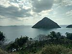
East Nusa Tenggara
|
East Nusa Tenggara Nusa Tenggara Timur |
|||||||||
|---|---|---|---|---|---|---|---|---|---|
| Province | |||||||||
From top, left to right : Kelimutu, Nature in Flores, Boa Beach in Rote Ndao Regency, Labuan Bajo, view of Komodo Island, Dancers in Watublapi in traditional costume, Kukusan Island in Flores
|
|||||||||
|
|||||||||
 Location of East Nusa Tenggara in Indonesia |
|||||||||
| Coordinates: 10°11′S 123°35′E / 10.183°S 123.583°ECoordinates: 10°11′S 123°35′E / 10.183°S 123.583°E | |||||||||
| Country |
|
||||||||
| Established | December 17, 1958 | ||||||||
| Capital |
|
||||||||
| Government | |||||||||
| • Body | East Nusa Tenggara Regional Government | ||||||||
| • Governor | Frans Lebu Raya (PDI-P) | ||||||||
| • Vice Governor | Benny Alexander Litelnoni | ||||||||
| Area | |||||||||
| • Total | 48,718.10 km2 (18,810.16 sq mi) | ||||||||
| Area rank | 13rd | ||||||||
| Highest elevation | 2,458 m (8,064 ft) | ||||||||
| Population (2014 Estimate) | |||||||||
| • Total | 5,070,746 | ||||||||
| • Rank | 12nd | ||||||||
| • Density | 100/km2 (270/sq mi) | ||||||||
| Demographics | |||||||||
| • Ethnic groups |
Atoni or Dawan (22%) Manggarai (15%) Sumba (12%) Belu (9%) Lamaholot (8%) Rote (5%) Lio (4%) |
||||||||
| • Religion |
Roman Catholicism (57.14%) Protestantism (35.74%) Islam (5.05%) Other (3%) |
||||||||
| • Languages | Indonesian, Kupang Malay, Lamaholot, Uab Meto, Bunak, Tetum | ||||||||
| Time zone | Indonesia Central Time (UTC+8) | ||||||||
| Postcodes | 80xxx, 81xxx, 82xxx | ||||||||
| Area codes | (62)3xx | ||||||||
| ISO 3166 code | ID-NT | ||||||||
| Vehicle sign | DH (Timor), EB (Flores, Alor, Lembata), ED (Sumba) | ||||||||
| HDI |
|
||||||||
| HDI rank | 31st (2014) | ||||||||
| Largest city by area | Kupang - 26.18 square kilometres (10.11 sq mi) | ||||||||
| Largest city by population | Kupang - (336,239 - 2010) | ||||||||
| Largest regency by area | East Sumba Regency - 7,000.50 square kilometres (2,702.91 sq mi) | ||||||||
| Largest regency by population | South Central Timor Regency - (441,155 - 2010) | ||||||||
| Website | Government official site | ||||||||
}} East Nusa Tenggara (Indonesian: Nusa Tenggara Timur – NTT) is the southernmost province of Indonesia. It is located in the eastern part of the Lesser Sunda Islands and includes West Timor. It has a total area of 48,718.1 km2, and the population at the 2010 Census was 4,683,827; the latest official estimate in January 2014 was 5,070,746. The provincial capital is Kupang on West Timor.
The province consists of more than 500 islands, the three largest being Flores, Sumba, and the western half of Timor (West Timor). The eastern part of Timor is the independent country of East Timor.
East Nusa Tenggara is the only province in Indonesia where Roman Catholicism is the predominant religion. Nusa Tenggara Timur, in Indonesian, means "eastern southeastern islands"; compare to Nusa Tenggara Barat, which means "western southeastern islands" where Lombok and Sumbawa are located.
After the declaration of Indonesian independence in 1945, the eastern part of Indonesia declared the State of East Indonesia. The state was further included in the United States of Indonesia as part of the agreement with the Dutch contained in the transfer its sovereignty to Indonesia in 1949.
In 1950, United States of Indonesia dissolved itself into a unitary state and began to divide its component area into provinces. In 1958, by Indonesian law (Undang-Undang) No. 64/1958, three provinces were established in the Lesser Sunda Islands, namely Bali, West Nusa Tenggara and East Nusa Tenggara. The area of East Nusa Tenggara province included the western part of Timor island, Flores, Sumba and other several small islands in the region. The province was sub-divided into twelve regencies and the City of Kupang, which had regency-level status.
...
Wikipedia


