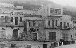
Ein al-Zeitun
| Ein al-Zeitun | |
|---|---|

Ein al-Zeitun, 1948
|
|
| Arabic | عين الزيتون |
| Name meaning | "spring of olives" |
| Also spelled | Ayn az-Zaytun |
| Subdistrict | Safad |
| Coordinates | 32°59′14.02″N 35°29′29.58″E / 32.9872278°N 35.4915500°ECoordinates: 32°59′14.02″N 35°29′29.58″E / 32.9872278°N 35.4915500°E |
| Palestine grid | 196/265 |
| Population | 820 (1945) |
| Area | 1,100 dunams 1.1 km² |
| Date of depopulation | May 2, 1948 |
| Cause(s) of depopulation | Military assault by Yishuv forces |
| Current localities | None |
Ein al-Zeitun, also spelled Ein Zaytun, Ein ez-Zeitun, Ain al-Zaytun or Ain el-Zeitun, was a Palestinian Arab village, located 1.5 kilometres (0.93 mi) north of Safad in the Upper Galilee. In 1945, the village had a population of 820 inhabitants and a total land area of 1,100 dunams. Ein al-Zeitun was entirely Muslim. The village's small population and land area as well as its proximity to Safad made it a suburb of the city. The village was depopulated in 1948, after the Ein al-Zeitun massacre.
Ein al-Zeitun was located on the western slope of Wadi al-Dilb, next to the highway leading to Safad, 1.5 kilometres (0.93 mi) north of the city.
Wadi al-Dilb may have been the wadi that Al-Dimashqi (d. 1327) called Wadi Dulayba, which he described as lying between Mirun and Safad. Al-Dimashqi described a spring where water gushed forward for one or two hours, allowing people to collect drinking water and wash, before it abruptly retreated. The village name, which was Arabic for "spring of olives", did indicate that there was a spring in the vicinity.
Under the Ottoman Empire in the 16th century, Ein al-Zeitun was a town in the nahiya ("subdistrict") of Jira, part of Sanjak Safad, with a mixed population of Muslims and Jews. Tax registers in 1596 recorded 59 Muslim households and 6 bachelors, plus 45 Jewish households and 3 bachelors. It paid taxes on olives, grapes, wheat and barley, as well as on vineyards and orchards.
The village was destroyed, along with Safed and other nearby villages, in an earthquake in 1837.
Victor Guérin, who visited in 1875, found a village with two springs, surrounded by slopes covered in olives, figs, walnuts and vegetables. The population consisted of 350 Muslims.
...
Wikipedia

