El Paso County, Colorado
| El Paso County, Colorado | |
|---|---|

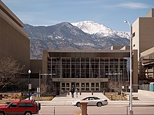
El Paso County Justice Center
|
|
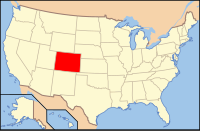
 Location in the U.S. state of Colorado |
|
 Colorado's location in the U.S. |
|
| Founded | November 1, 1861 |
| Named for | Spanish-language name for Ute Pass |
| Seat | Colorado Springs |
| Largest city | Colorado Springs |
| Area | |
| • Total | 2,130 sq mi (5,517 km2) |
| • Land | 2,127 sq mi (5,509 km2) |
| • Water | 2.7 sq mi (7 km2), 0.1% |
| Population (est.) | |
| • (2015) | 674,471 |
| • Density | 293/sq mi (113/km²) |
| Congressional district | 5th |
| Time zone | Mountain: UTC-7/-6 |
| Website | www |
|
Footnotes:
|
|
El Paso County is one of the 64 counties of the U.S. state of Colorado. As of the 2014 Census, the population was 663,519. The Census Bureau's 2014 estimate indicates it is the second most populous county in Colorado, after the City and County of Denver. The county seat is Colorado Springs, the second most populous city in Colorado.
El Paso County is included in the Colorado Springs, CO Metropolitan Statistical Area.
El Paso County is located in Colorado's 5th congressional district. Since its creation in 1871, El Paso County has typically voted for the Republican presidential candidate in presidential elections; the last Democratic nominee to win the county was Lyndon B. Johnson in 1964. The Democratic Party won El Paso County four additional times prior, and the Populist Party won in 1892, with General James B. Weaver.
In 2004, the voters of Colorado Springs and El Paso County established the Pikes Peak Rural Transportation Authority (PPRTA) and adopted a 1% sales tax dedicated to improving the region's transportation infrastructure. Together with state funding for COSMIX (2007 completion) and the I-25 interchange with Highway 16 (2008 completion), significant progress has been made since 2003 in addressing the transportation needs of the area. In 2010 and 2014 the county voted pro-marijuana.
...
Wikipedia
