Electoral district of Riverton
|
Riverton Western Australia—Legislative Assembly |
|
|---|---|

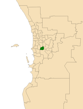
Location of Riverton (dark green) in the Perth metropolitan area
|
|
| State | Western Australia |
| Dates current | 1989–present |
| MP | Mike Nahan |
| Party | Liberal |
| Namesake | Riverton |
| Electors | 25,368 (2017) |
| Area | 20 km2 (7.7 sq mi) |
| Demographic | South Metropolitan |
The Electoral district of Riverton is a Legislative Assembly electorate in the state of Western Australia. Riverton is named for the southern Perth suburb of Riverton which falls within its borders.
Riverton was created at the 1988 redistribution, replacing the abolished district of Clontarf, which had been a safe Liberal seat since a redistribution prior to the 1977 election. Riverton was first contested at the 1989 election, at which Liberal Party member Graham Kierath was successful. He served as a minister in the Court government, and held the seat until his unexpected defeat at the 2001 election on a 10.16% swing. The seat was then held by Tony McRae of the Australian Labor Party, until his defeat by the Liberal Party's Mike Nahan in 2008 election. McRae was the Minister for Environment, Climate Change and Disability Services between 2006 and 2008.
Riverton is bounded by the Canning River to the north, Bannister Creek and High Road to the northeast, Nicholson Road to the east, the freight railway and South Street to the south, and Karel Avenue and Fifth Avenue to the west. Its boundaries include the suburbs of Parkwood, Riverton, Shelley, Willetton, Bull Creek and the Canning Vale industrial area and markets.
...
Wikipedia
