Emmetten
| Emmetten | ||
|---|---|---|
 |
||
|
||
| Coordinates: 46°57′N 8°31′E / 46.950°N 8.517°ECoordinates: 46°57′N 8°31′E / 46.950°N 8.517°E | ||
| Country | Switzerland | |
| Canton | Nidwalden | |
| District | n.a. | |
| Area | ||
| • Total | 24.93 km2 (9.63 sq mi) | |
| Elevation | 774 m (2,539 ft) | |
| Population (Dec 2015) | ||
| • Total | 1,380 | |
| • Density | 55/km2 (140/sq mi) | |
| Postal code | 6376 | |
| SFOS number | 1504 | |
| Surrounded by | Beckenried, Gersau (SZ), Ingenbohl (SZ), Isenthal (UR), Seelisberg (UR) | |
| Website |
www SFSO statistics |
|
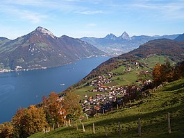
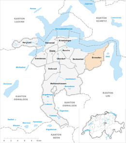
Emmetten is a municipality in the canton of Nidwalden in Switzerland.
Emmetten is first mentioned about 1160 as Empnoten.
Emmetten has an area, as of 2006[update], of 25 square kilometers (9.7 sq mi). Of this area, 37.9% is used for agricultural purposes, while 45.8% is forested. Of the rest of the land, 2.6% is settled (buildings or roads) and the remainder (13.7%) is non-productive (rivers, glaciers or mountains).
The municipality is located along the cantonal highway between Beckenried and Seelisberg on both sides of the Egg crossing over the edge of Lake Lucerne.
Emmetten has a population (as of 31 December 2015) of 1,380. As of 2007[update], 15.4% of the population was made up of foreign nationals. Over the last 10 years the population has grown at a rate of 3.7%. Most of the population (as of 2000[update]) speaks German (91.8%), with English being second most common ( 1.8%) and Italian being third ( 1.5%). As of 2008[update] the gender distribution of the population was 53.4% male and 46.6% female.
As of 2000[update] there are 487 households, of which 310 households (or about 63.7%) contain only one or two individuals. 36 or about 7.4% are large households, with at least five members.
In the 2007 federal election the most popular party was the FDP which received 87.1% of the vote. Most of the rest of the votes went to local small right-wing parties (9.9%).
...
Wikipedia


