Englishcombe
| Englishcombe | |
|---|---|
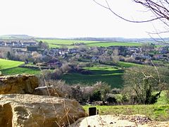
 View of Englishcombe |
|
| Englishcombe shown within Somerset | |
| Population | 318 |
| OS grid reference | ST717627 |
| Unitary authority | |
| Ceremonial county | |
| Region | |
| Country | England |
| Sovereign state | United Kingdom |
| Post town | Bath |
| Postcode district | BA2 |
| Police | Avon and Somerset |
| Fire | Avon |
| Ambulance | South Western |
| EU Parliament | South West England |
| UK Parliament | |
Englishcombe is a village and civil parish in Bath and North East Somerset just outside Bath, England. The parish, which also includes the hamlets of Inglesbatch, Nailwell and Wilmington, has a population of 318.
A neolithic axe has been found in the parish, and Iron Age pottery was discovered during construction of Culverhay School. There is some evidence of two barrows.
The south eastern boundary of the parish follows the route of the Fosse Way a Roman road that linked Exeter (Isca Dumnoniorum) in South West England to Lincoln (Lindum Colonia) in the East Midlands, via Ilchester (Lindinis), Bath (Aquae Sulis), Cirencester (Corinium) and Leicester (Ratae Corieltauvorum).
The village lies on the route of the Wansdyke (from Woden's Dyke) an early medieval or possibly defining a Roman boundary with a series of defensive linear earthworks, consisting of a ditch and a running embankment from the ditch spoil, with the ditching facing north. Its construction is attributed to the Saxons, probably in the late sixth century. The parish of Englishcombe was part of the Wellow Hundred.
...
Wikipedia

