Gera, Germany
| Gera | ||
|---|---|---|

A view of Gera
|
||
|
||
| Coordinates: 50°52′50″N 12°05′00″E / 50.88056°N 12.08333°ECoordinates: 50°52′50″N 12°05′00″E / 50.88056°N 12.08333°E | ||
| Country | Germany | |
| State | Thuringia | |
| District | Urban district | |
| First mentioned | 995 | |
| Government | ||
| • Lord Mayor | Viola Hahn | |
| Area | ||
| • Total | 151.93 km2 (58.66 sq mi) | |
| Elevation | 205 m (673 ft) | |
| Population (2016-12-31) | ||
| • Total | 94,750 | |
| • Density | 620/km2 (1,600/sq mi) | |
| Time zone | CET/CEST (UTC+1/+2) | |
| Postal codes | 07545–07557 | |
| Dialling codes | 0365, 0336695 | |
| Vehicle registration | G | |
| Website | www.gera.de | |
| Largest groups of foreign residents | |
| Nationality | Population (31.12.2017) |
|---|---|
|
|
2,032 |
|
|
467 |
|
|
393 |
|
|
275 |
|
|
210 |
|
|
176 |
|
|
157 |
|
|
152 |
|
|
150 |
|
|
146 |
|
|
143 |
|
|
140 |
|
|
103 |
|
|
101 |
Gera is the third-largest city in Thuringia, Germany, with 96,000 inhabitants, located 55 kilometres (34 miles) south of Leipzig, 75 km (47 miles) east of Erfurt and 120 km (75 miles) west of Dresden.
Gera was first mentioned in 995 and developed to a city during the 13th century. Later, it was the residence of several lines of the Reussians until the end of monarchy in Germany in 1918. Over the 19th century, Gera became a centre of the textile industry and saw a period of rapid growth. In 1952, the city also became an administrative centre in GDR as one of the capitals of Gera administrative district (Bezirk). In 1990, Gera became part of re-established Thuringia. The loss of its administrative functions as well as its industrial core (caused both by structural change among the European textile industry and the economic system change after the German reunification) precipitated the city's slide into an enduring economic crisis.
Since 1990, many of Gera's buildings have been restored and big urban planning programmes like the Bundesgartenschau 2007 were implemented to stimulate Gera's economy. Sights include some retained buildings of the royal residence epoque and a large number of public and private buildings from the economic heyday between 1870 and 1930. The famous painter Otto Dix was born in Gera in 1891.
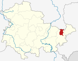
Gera lies in a hilly landscape in the east of Thuringia, within the wide valley of the Weiße Elster river.
The place name Gera originally referred to the area of the Elster river valley where the city stands now. The name most likely originated before the European Migration Period – the Slavic people who first settled the area during the 8th century adopted the name. The first known documentary mention of Gera dates from 995.
In 999 Emperor Otto III assigned the "province" of Gera to the Quedlinburg Abbey. In turn, the church assigned the protectorship of this area in 1209 to the Vogts of Weida (in German: Vögte von Weida) who served as its administrators. The Vogts of Weida were the ancestors of the Reussians, who ruled Gera until 1918. Gera was first mentioned as a town in 1237, though it is unclear in which year Gera got the municipal law. The small town got circumvallated in the 13th century on an area of 350 x 350 m and the Vogts' city castle was built in the south-western corner at today's Burgstraße. A municipal seal was first used in 1350, the council was first named in 1360 and the town hall was mentioned in 1426. The abbess of Quedlinburg remained the formal sovereign of Gera until 1358, as the Wettins followed her up. The Vogt's couldn't emancipate theirselfs from Wettin rule. In 1450, Gera was almost totally destroyed during the Saxon Fratricidal War, but it could recuperate quick because the starting textile manufacture brought wealth to the town.
...
Wikipedia


