Germantown, Illinois
| Germantown, Illinois | |
| Village | |
| Country | United States |
|---|---|
| State | Illinois |
| County | Clinton |
| Coordinates | 38°33′15″N 89°32′22″W / 38.55417°N 89.53944°WCoordinates: 38°33′15″N 89°32′22″W / 38.55417°N 89.53944°W |
| Area | 0.87 sq mi (2 km2) |
| - land | 0.87 sq mi (2 km2) |
| - water | 0.00 sq mi (0 km2) |
| Population | 1,269 (2010) |
| Density | 1,458.6/sq mi (563/km2) |
| Timezone | CST (UTC-6) |
| - summer (DST) | CDT (UTC-5) |
| Postal code | 62245 |
| Area code | 618 |
|
Location in Clinton County and the state of Illinois.
|
|
|
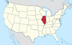
Location of Illinois in the United States
|
|
|
Website: www |
|
Germantown is a village in Clinton County, Illinois, United States. The population was 1,269 at the 2010 census.
The village of Germantown was established in 1833. Formerly known as "Hanover" for the city in Germany that was the hometown of the first settlers, Germantown is said to be one of the first true German settlements in Illinois.
Germantown is located in western Clinton County at 38°33′15″N 89°32′22″W / 38.55417°N 89.53944°W (38.554180, -89.539315).Illinois Route 161 runs along the southern border of the village, leading east 22 miles (35 km) to Centralia and west 9 miles (14 km) to New Baden. St. Louis is 39 miles (63 km) to the west via Interstate 64.
According to the 2010 census, Germantown has a total area of 0.87 square miles (2.25 km2), all land.
As of the census of 2000, there were 1,118 people, 444 households, and 322 families residing in the village. The population density was 1,408.8 people per square mile (546.4/km²). There were 459 housing units at an average density of 578.4 per square mile (224.3/km²). The racial makeup of the village was 99.19% White, 0.18% Asian, 0.27% from other races, and 0.36% from two or more races. Hispanic or Latino of any race were 0.54% of the population. There are approximately 5 non-white people here according to this equation.
...
Wikipedia


