Glen Hope, Pennsylvania
| Glen Hope, Pennsylvania | |
|---|---|
| Borough | |
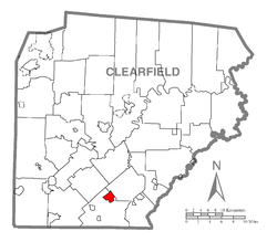
 Map showing Glen Hope in Clearfield County |
|
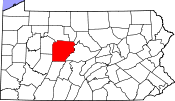
 Map showing Clearfield County in Pennsylvania |
|
| Pennsylvania | |
| Coordinates: 40°47′56″N 78°30′01″W / 40.79889°N 78.50028°WCoordinates: 40°47′56″N 78°30′01″W / 40.79889°N 78.50028°W | |
| Country | United States |
| State | Pennsylvania |
| County | Clearfield |
| Incorporated | 1878 |
| Government | |
| • Type | Borough Council |
| Area | |
| • Total | 2.17 sq mi (5.63 km2) |
| • Land | 2.13 sq mi (5.52 km2) |
| • Water | 0.04 sq mi (0.12 km2) |
| Elevation | 1,370 ft (420 m) |
| Population (2010) | |
| • Total | 142 |
| • Estimate (2016) | 139 |
| • Density | 65.29/sq mi (25.20/km2) |
| Time zone | Eastern (EST) (UTC-5) |
| • Summer (DST) | EDT (UTC-4) |
| ZIP code | 16645 |
| Area code(s) | 814 |
| FIPS code | 42-29632 |
Glen Hope is a borough in Clearfield County, Pennsylvania, United States. The population was 142 at the 2010 census.
Glen Hope is located in southern Clearfield County at 40°47′56″N 78°30′1″W / 40.79889°N 78.50028°W (40.798959, -78.500320), primarily on the north side of Clearfield Creek, a northeast-flowing tributary of the West Branch Susquehanna River. Pennsylvania Route 53 passes through the borough, leading northeast 4 miles (6 km) to Madera and southwest 4 miles (6 km) to Irvona. Pennsylvania Route 729 crosses Clearfield Creek and PA-53 in the center of town and leads northwest 16 miles (26 km) to Grampian and southeast 5 miles (8 km) to Janesville.
According to the United States Census Bureau, Glen Hope has a total area of 2.2 square miles (5.6 km2), of which 0.04 square miles (0.1 km2), or 2.06%, is water.
As of the census of 2000, there were 149 people, 55 households, and 44 families residing in the borough. The population density was 72.0 people per square mile (27.8/km²). There were 59 housing units at an average density of 28.5 per square mile (11.0/km²). The racial makeup of the borough was 99.33% White, and 0.67% from two or more races.
...
Wikipedia

