Golinda, Texas
| Golinda, Texas | |
|---|---|
| City | |

This Citgo gas station is the only business in Golinda.
|
|
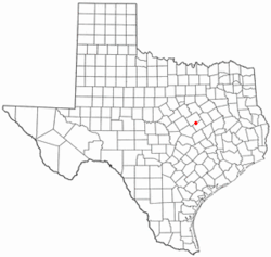
 Location of Golinda, Texas |
|
 |
|
| Coordinates: 31°22′39″N 97°4′29″W / 31.37750°N 97.07472°WCoordinates: 31°22′39″N 97°4′29″W / 31.37750°N 97.07472°W | |
| Country | United States |
| State | Texas |
| Counties | Falls, McLennan |
| Area | |
| • Total | 4.1 sq mi (10.6 km2) |
| • Land | 4.1 sq mi (10.5 km2) |
| • Water | 0.04 sq mi (0.1 km2) |
| Elevation | 482 ft (147 m) |
| Population (2010) | |
| • Total | 559 |
| • Density | 139/sq mi (53.5/km2) |
| Time zone | Central (CST) (UTC-6) |
| • Summer (DST) | CDT (UTC-5) |
| ZIP code | 76655 |
| Area code(s) | 254 |
| FIPS code | 48-30092 |
| GNIS feature ID | 1358136 |
Golinda is a city in Falls and McLennan counties in the U.S. state of Texas. The population was 559 at the 2010 census, up from 423 at the 2000 census.
The McLennan County portion of Golinda is part of the Waco Metropolitan Statistical Area.
Golinda is located primarily in northern Falls County at 31°22′39″N 97°4′29″W / 31.37750°N 97.07472°W (31.377615, -97.074772). The city limits extend north into southern McLennan County.
U.S. Route 77 passes through Golinda, leading north 13 miles (21 km) to Waco and south 38 miles (61 km) to Cameron.
According to the United States Census Bureau, the city of Golinda has a total area of 4.1 square miles (10.6 km2), of which 0.04 square miles (0.1 km2), or 0.97%, is water.
As of the census of 2000, there were 423 people, 171 households, and 128 families residing in the city. The population density was 101.8 people per square mile (39.4/km²). There were 185 housing units at an average density of 44.5 per square mile (17.2/km²). The racial makeup of the city was 76.36% White, 19.15% African American, 0.24% Asian, 4.26% from other races. Hispanic or Latino of any race were 8.27% of the population.
...
Wikipedia
