Greater Dayton
| Metro Dayton, The Miami Valley, Greater Dayton | |
|---|---|
| Dayton | |
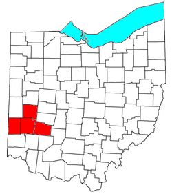
 The Dayton Metropolitan Area. |
|
| Country | United States |
| State(s) | Ohio |
| Largest city | Dayton |
| Other cities |
- Kettering - Centerville |
| Area | |
| • Total | 1,715 sq mi (4,440 km2) |
| Population | |
| • Total | 799,232 |
| • Rank | 61 st in the U.S. |
| • Density | 478/sq mi (185/km2) |
- Kettering
- Beavercreek
- Huber Heights
- Fairborn
The Dayton metropolitan area is the metropolitan area centered on Dayton, Ohio. It is the fourth largest metropolitan area in the state of Ohio, behind Cincinnati, Cleveland, and Columbus.
Dayton Metropolitan Area (also known as Greater Dayton), as defined by the United States Census Bureau, is an area consisting of three counties in the Miami Valley region of Ohio and is anchored by the city of Dayton. As of 2000 it is the fourth largest metropolitan area in Ohio and the 61st largest Metropolitan Area by Population in the United States. As of the 2010 census, the MSA had a population of 799,232 based on a change in MSA defining criteria as of 2013, which eliminated Preble County. This exclusion was applied retroactively to the 2010 population figures.
The Dayton-Springfield-Greenville-Sidney Combined Statistical Area is a CSA in the U.S. state of Ohio, as defined by the United States Census Bureau. It consists of the Dayton Metropolitan Statistical Area (the counties of Montgomery, Greene and Miami); the Springfield Metropolitan Statistical Area (Clark County); the Urbana Micropolitan Statistical Area (Champaign County); the Greenville Micropolitan Statistical Area (Darke County); and the Sidney Micropolitan Statistical Area (Shelby County). As of the 2010 Census, the CSA had a population of 1,080,044.
...
Wikipedia
