Greenbrier River
| Greenbrier River | |
| River | |
|
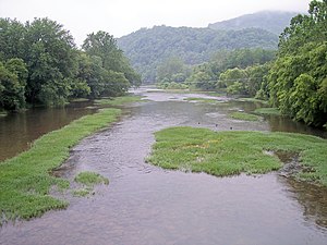
Greenbrier River at Marlinton, West Virginia
|
|
| Country | United States |
|---|---|
| State | West Virginia |
| Counties | Greenbrier, Monroe, Pocahontas, Summers |
| Tributaries | |
| - right | Anthony Creek (Greenbrier River), Knapp Creek |
| Source | West Fork Greenbrier River |
| - location | Pocahontas County |
| - elevation | 3,396 ft (1,035 m) |
| - coordinates | 38°44′07″N 79°45′37″W / 38.73528°N 79.76028°W |
| Secondary source | East Fork Greenbrier River |
| - location | Pocahontas County |
| - elevation | 3,746 ft (1,142 m) |
| - coordinates | 38°41′04″N 79°39′31″W / 38.68444°N 79.65861°W |
| Source confluence | |
| - location | Durbin |
| - elevation | 2,710 ft (826 m) |
| - coordinates | 38°32′37″N 79°49′56″W / 38.54361°N 79.83222°W |
| Mouth | New River |
| - location | Hinton |
| - elevation | 1,365 ft (416 m) |
| - coordinates | 37°39′13″N 80°53′05″W / 37.65361°N 80.88472°WCoordinates: 37°39′13″N 80°53′05″W / 37.65361°N 80.88472°W |
| Length | 162 mi (261 km) |
| Basin | 1,656 sq mi (4,289 km2) |
| Discharge | for Alderson |
| - average | 2,600 cu ft/s (74 m3/s) |
| - max | 10,200 cu ft/s (289 m3/s) (2000) |
| - min | 576 cu ft/s (16 m3/s) (1976) |
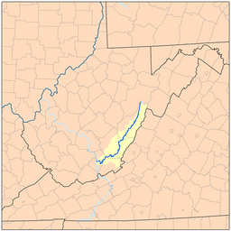
The Greenbrier River is a tributary of the New River, 173 miles (278 km) long, in southeastern West Virginia, in the United States. Via the New, Kanawha and Ohio rivers, it is part of the watershed of the Mississippi River, draining an area of 1,656 square miles (4,290 km2). It is one of the longest rivers in West Virginia.
The Greenbrier is formed at Durbin in northern Pocahontas County by the confluence of the East Fork Greenbrier River and the West Fork Greenbrier River, both of which are short streams rising at elevations exceeding 3,300 feet (1,000 m) and flowing for their entire lengths in northern Pocahontas County. From Durbin the Greenbrier flows generally south-southwest through Pocahontas, Greenbrier and Summers Counties, past several communities including Cass, Marlinton, Hillsboro, Ronceverte, Fort Spring, Alderson, and Hinton, where it flows into the New River.
Along most of its course, the Greenbrier accommodated the celebrated Indian warpath known as the Seneca Trail (Great Indian Warpath). From the vicinity of present-day White Sulphur Springs the Trail followed Anthony's Creek down to the Greenbrier near the present Pocahontas-Greenbrier County line. It then ascended the River to the vicinity of Hillsboro and Droop Mountain and made its way through present Pocahontas County by way of future Marlinton, Indian Draft Run, and Edray.
...
Wikipedia


